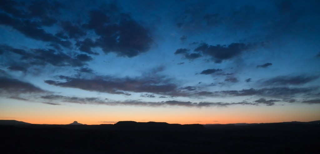
We headed up to Abiquiu with some friends for a long weekend. Between Althea being on bedrest during heartworm treatment, Perry being old, and the baby having a short window in which he’s not hungry/tired/cold, the hikes were kept short and easy, but man, is that some beautiful country!
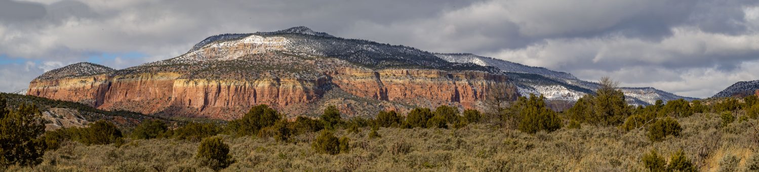
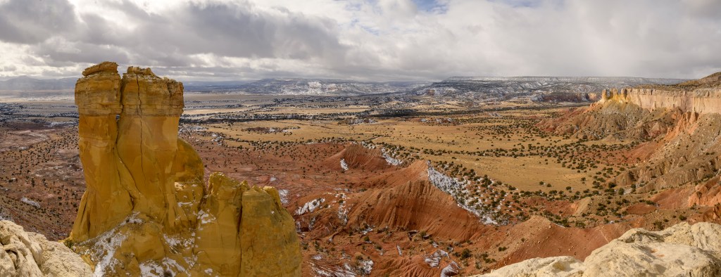
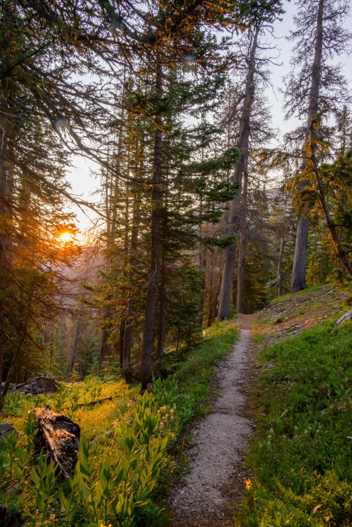
Looking over Ghost Ranch on the Chimney Rock trail
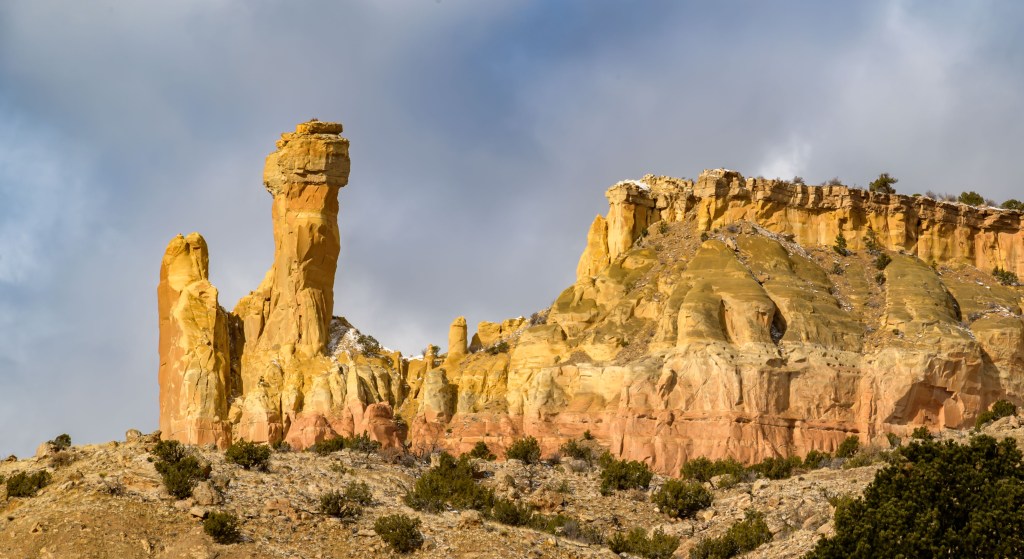
We headed to Ghost Ranch, famously where Georgia O’Keefe lived and painted in the latter part of her life. Lots more to explore there, but we did the Chimney Rock trail.
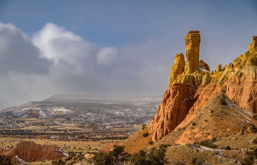
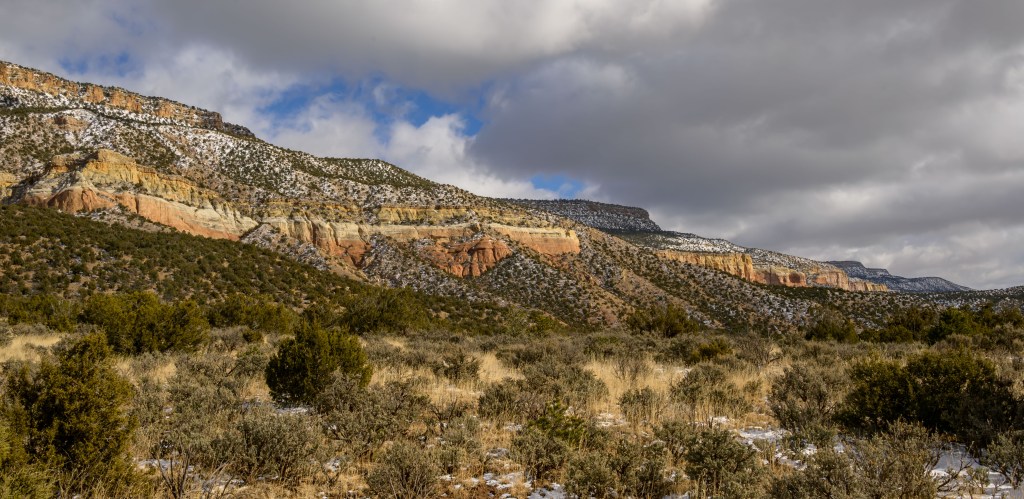
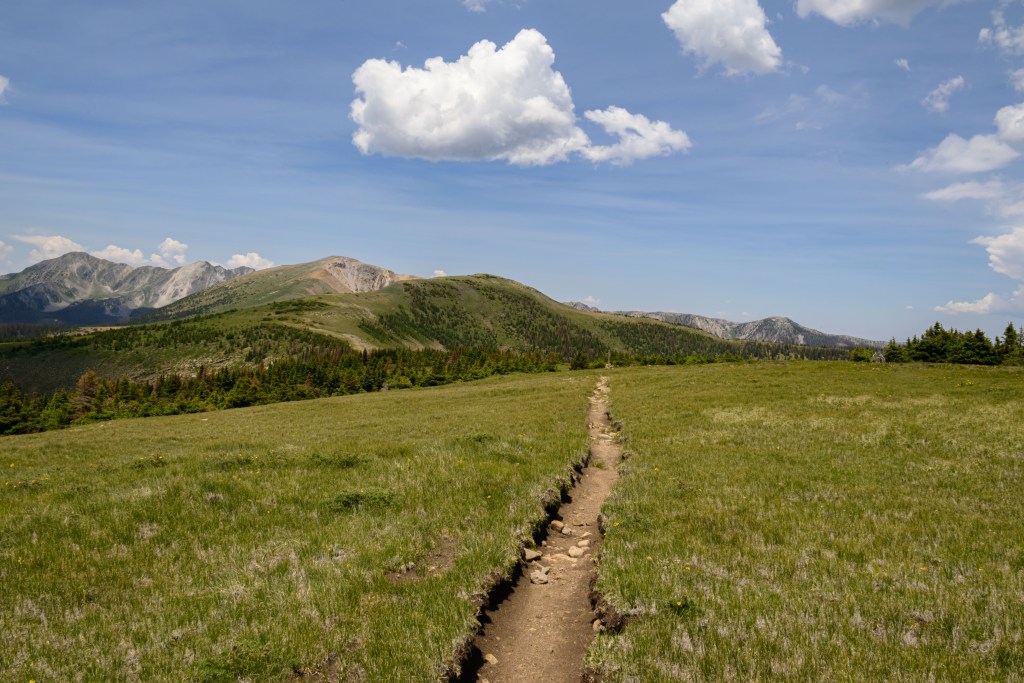
Chimney Rock at Ghost Ranch, views approaching as well as from behind it at the end of the trail
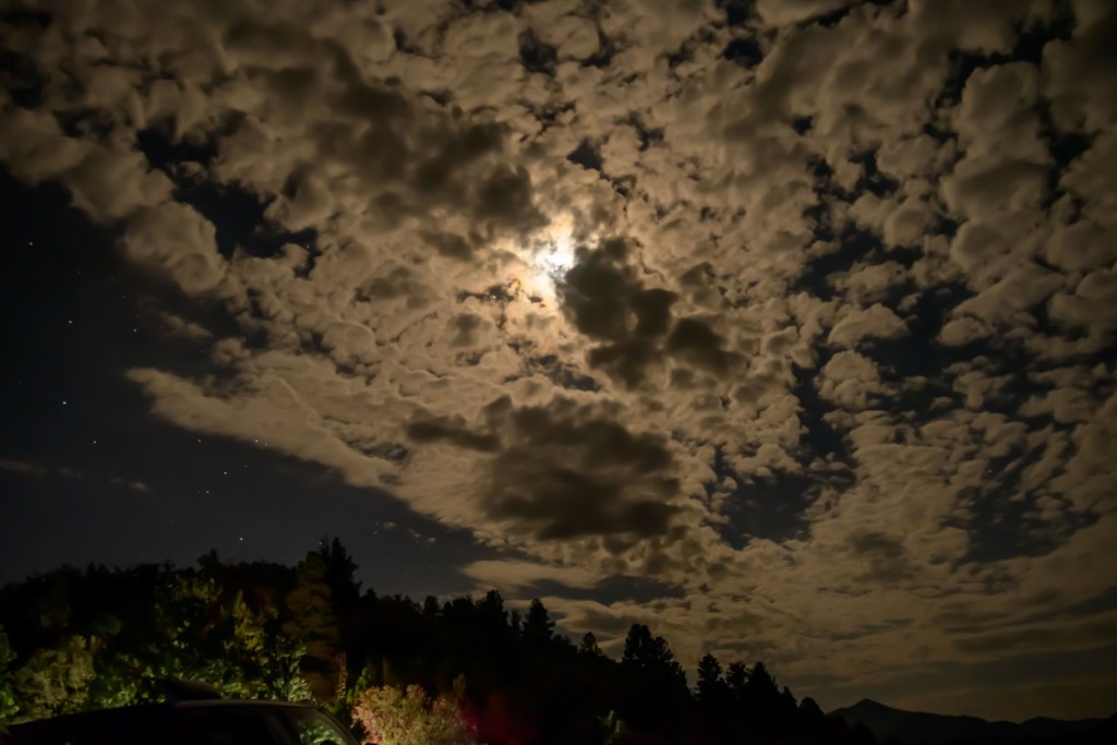
I was concerned at first that the cloud coverage would make for a dull photography session, but in the end, the sun played peak-a-boo all day. With a little assistance from my hiking friends pointing out every single time the sun made an appearance (thanks guys, that was tremendously helpful), and lots of repetition, I managed to down-select a few choice ones. Far from dull, the shy sun and snowy clouds in the end made for some striking photos.
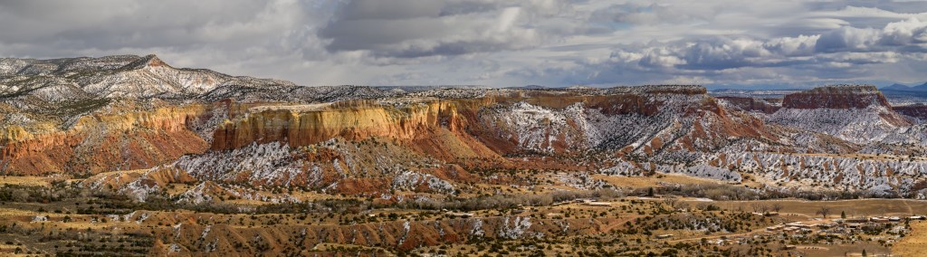
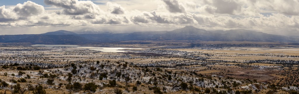
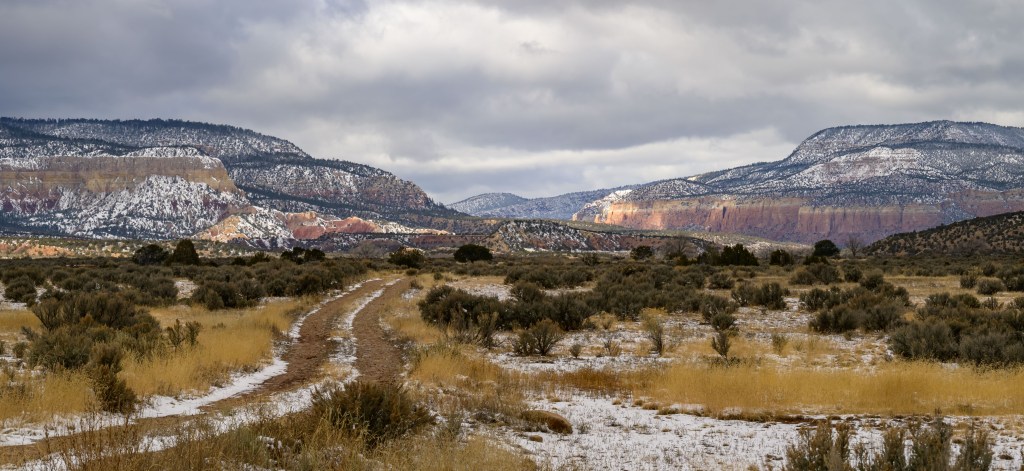
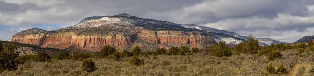
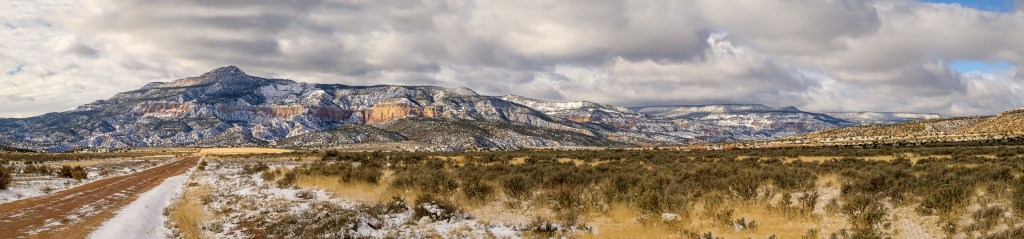
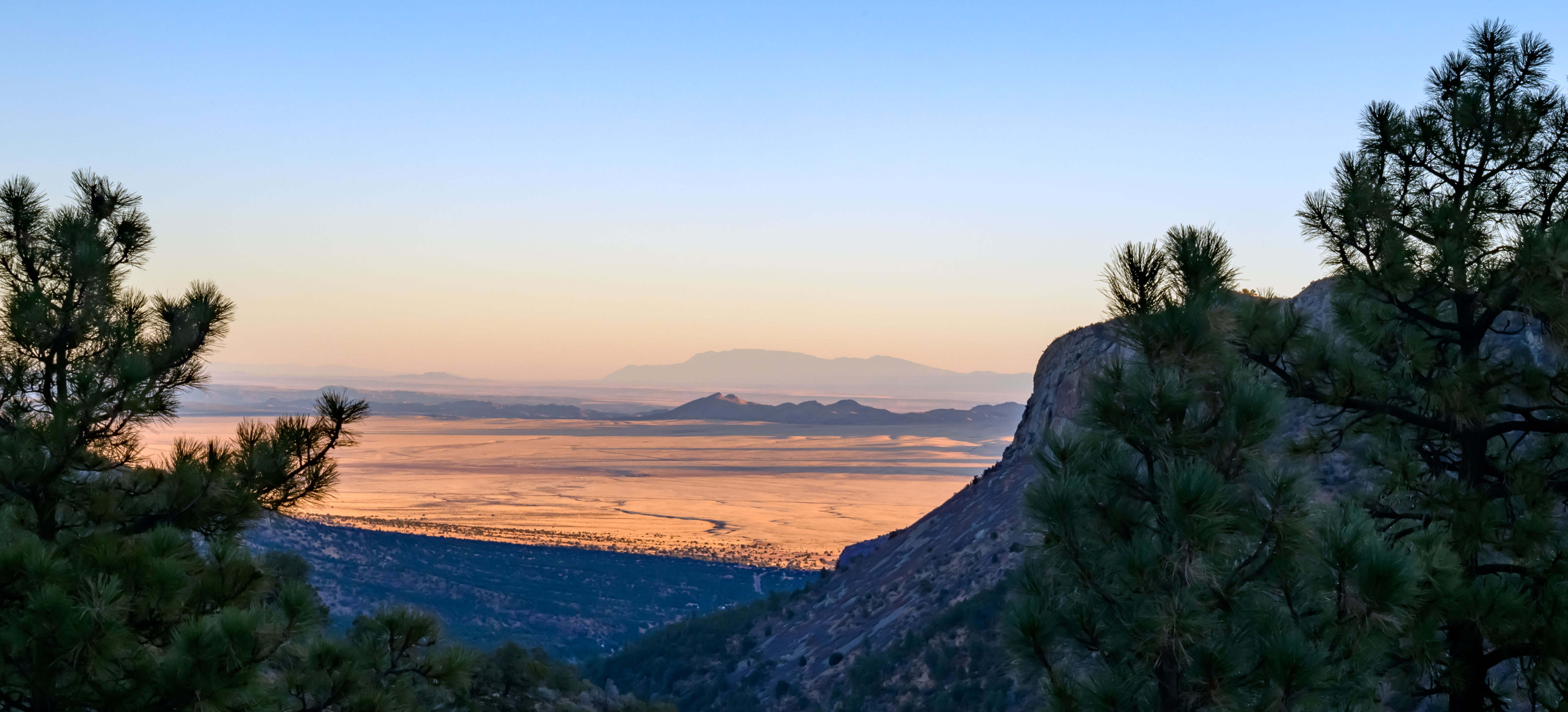
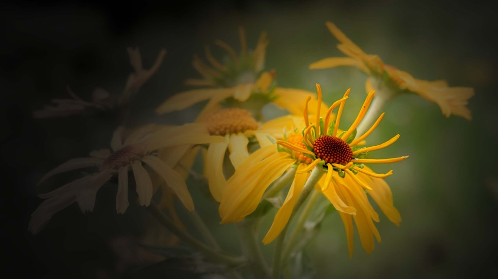
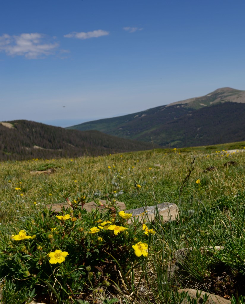
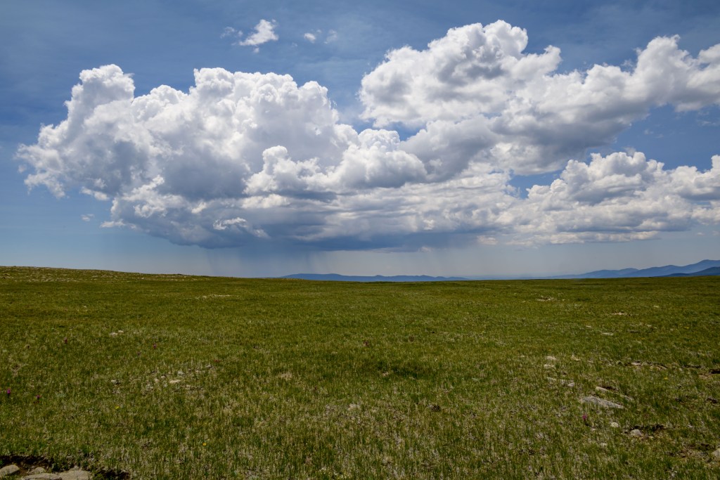
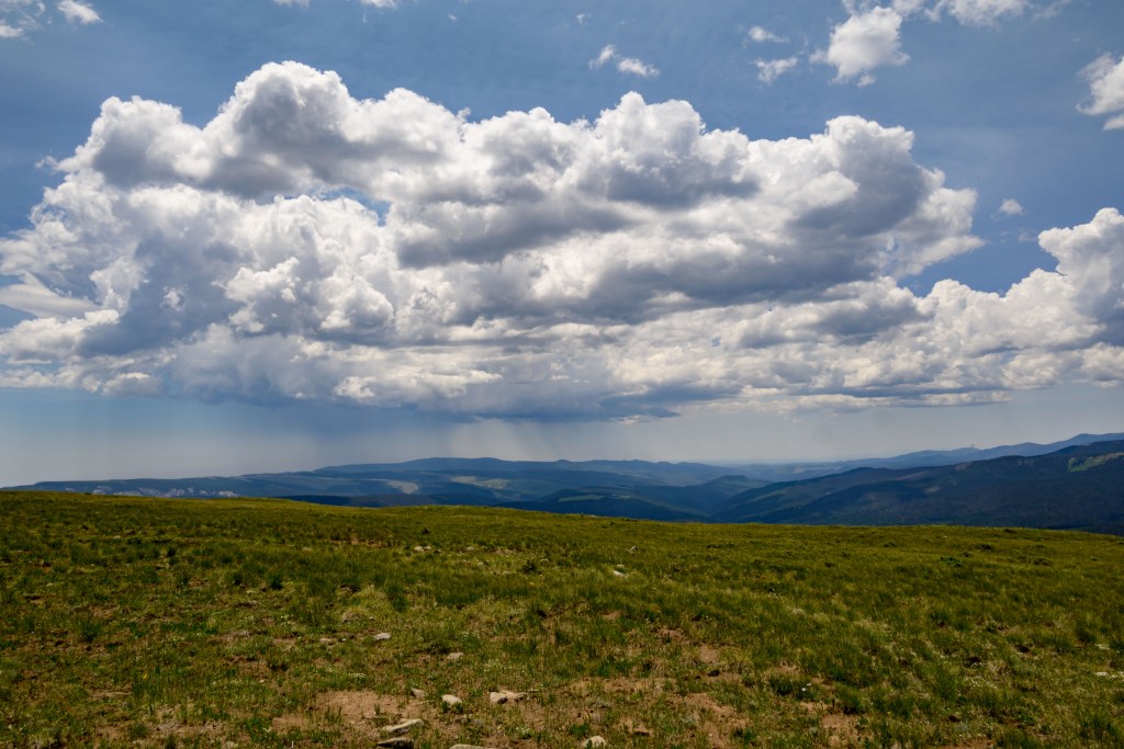
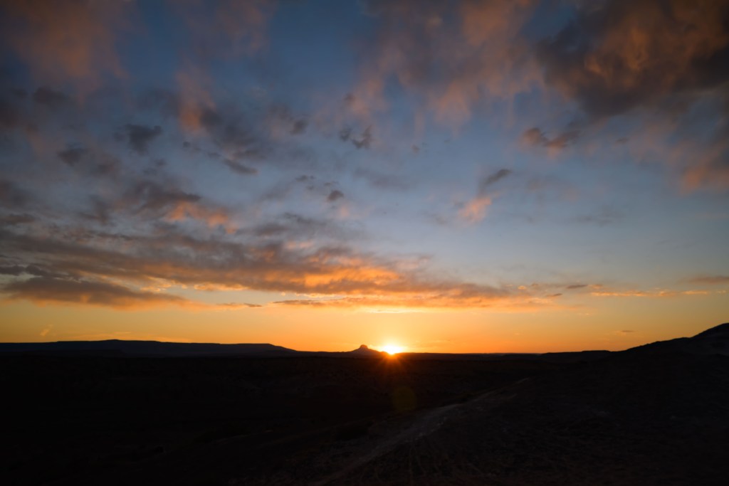
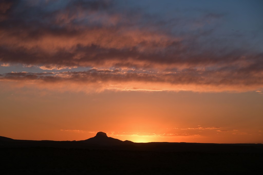
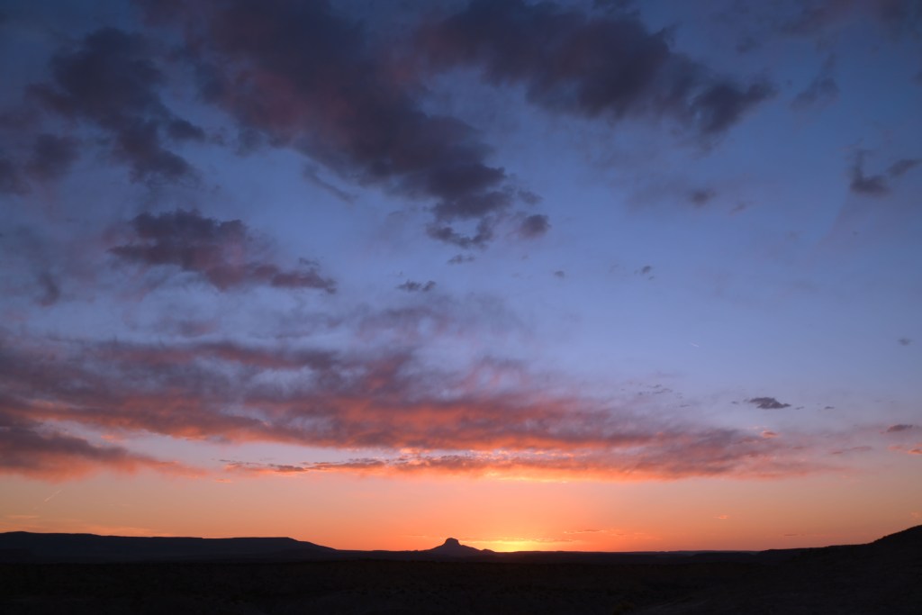
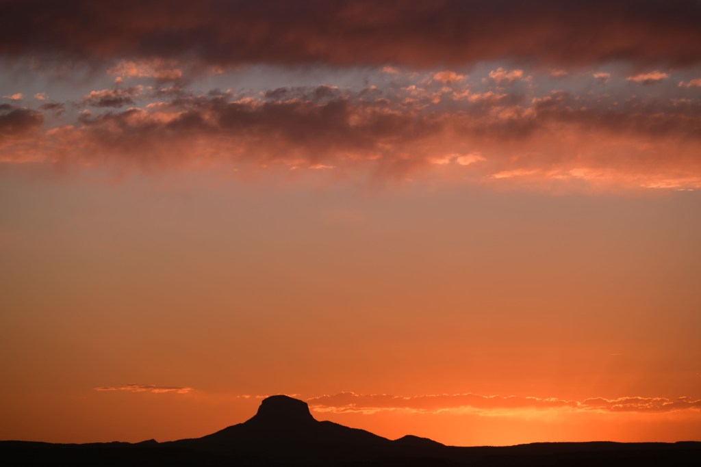
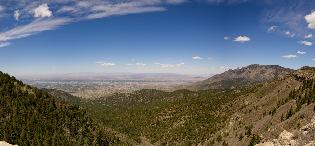
Cerro Pedernal and Abiquiu reservoir, as seen on the Chimney Rock trail
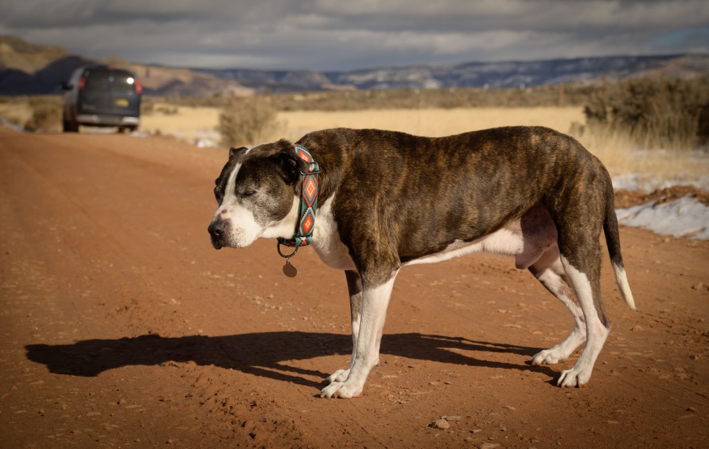
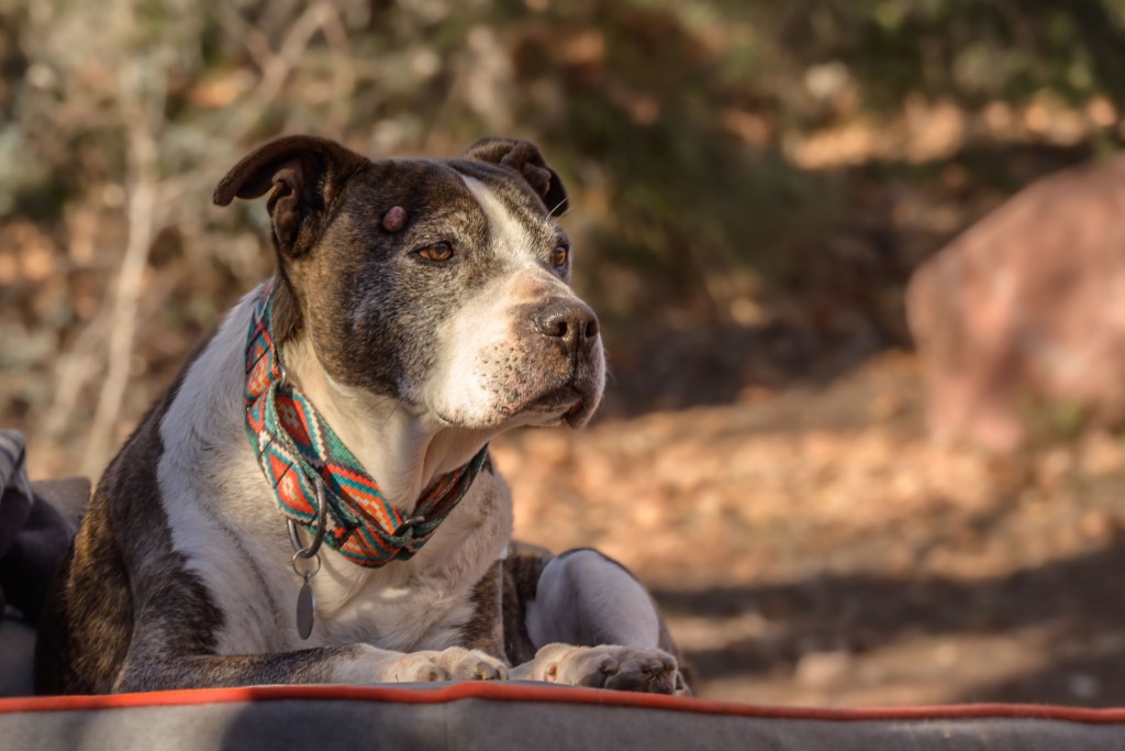
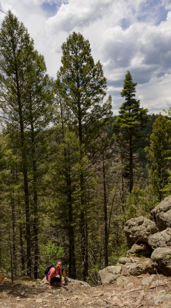
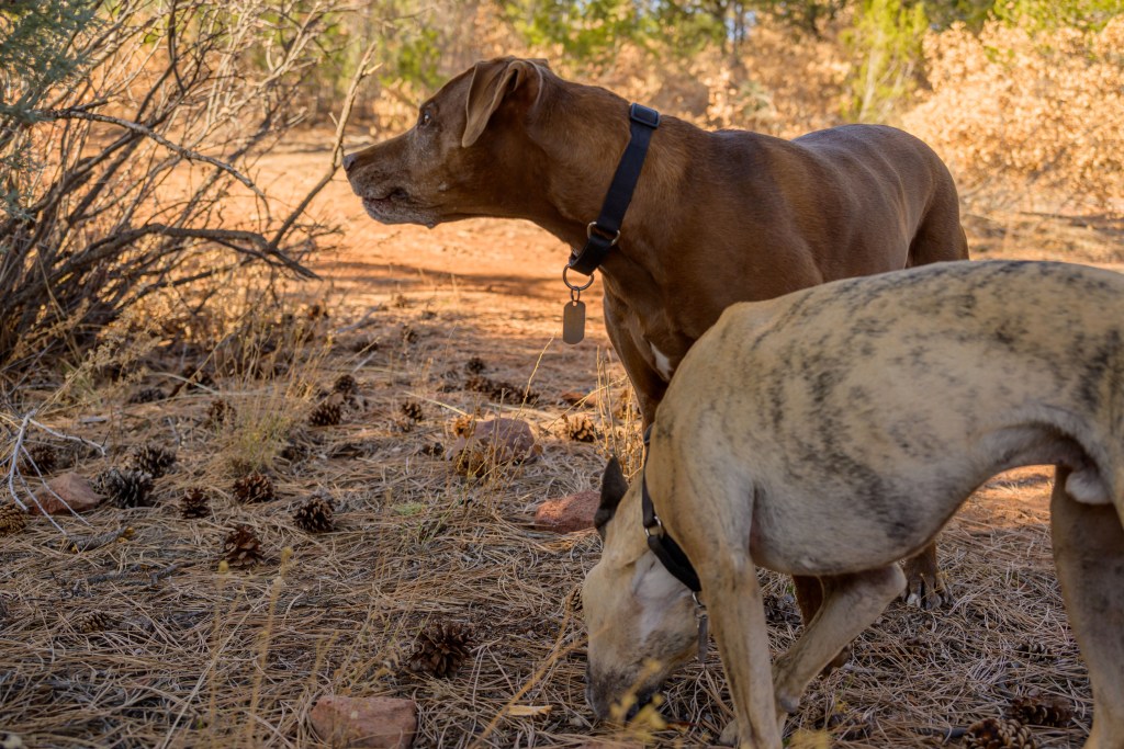
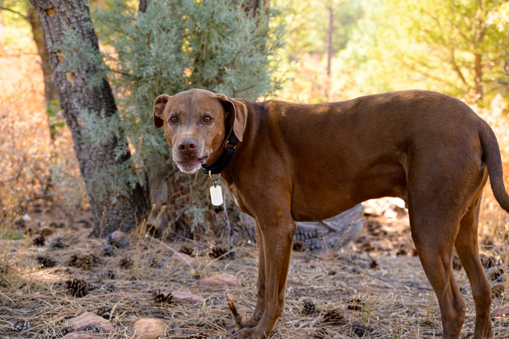
Althea enjoyed the hike as well, especially the snow, of which the best bites—she assured us—were on the steepest slopes, practically cliff faces shearing off the edge of the trail. That’s what she said. Perry, on the other hand—well, have you ever wondered where the expression “hang dog” comes from? It can be hard being 107 years old.
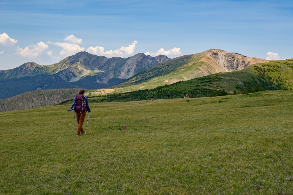
Althea on the Chimney Rock trail and Perry on FR 151
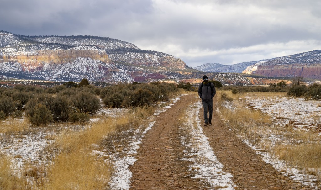
The next day, we headed down FR 151 with the goal of visiting the Monastery of Christ in the Desert at the end of the road.
Valley of the Chama River on FR 151
Turns out the Monastery was undergoing renovations and was closed, but I do not regret the 2-hour drive. What an amazingly beautiful valley! There were several dispersed camping areas along the Chama River as well that we will have to explore more this summer. (Though, there was one dingbat tent-camping in January.)
FR 151 along the Chama River valley
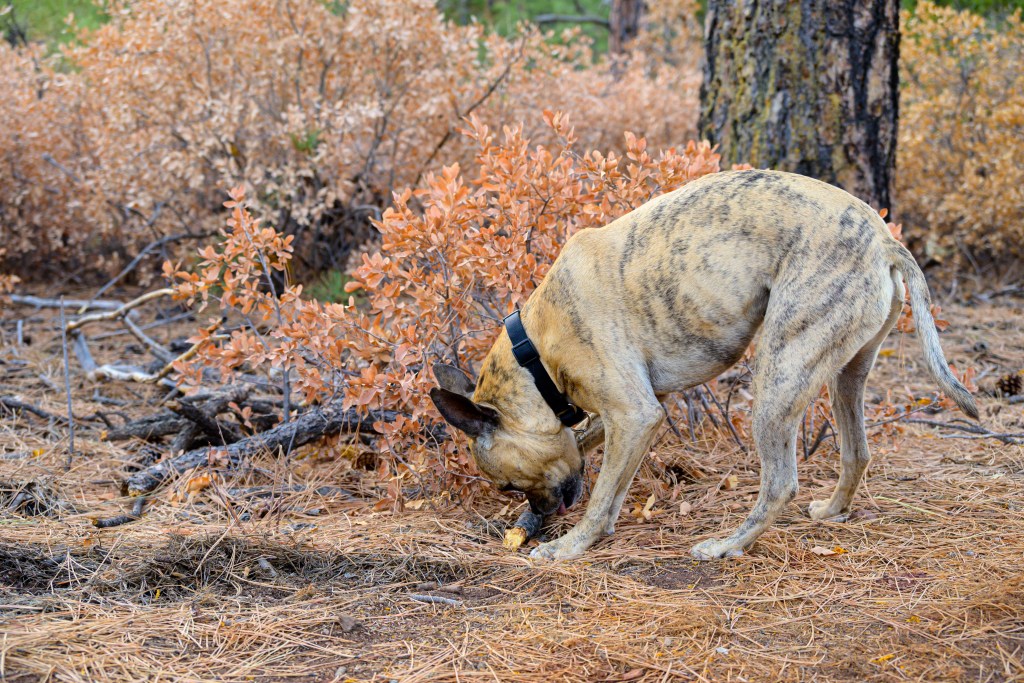
Althea and Perry enjoyed stopping while I took pictures, too. It was pretty breezey—look at Perceval’s ears blowing in the wind, and his squinty eyes!
Althea and Perry on FR 151
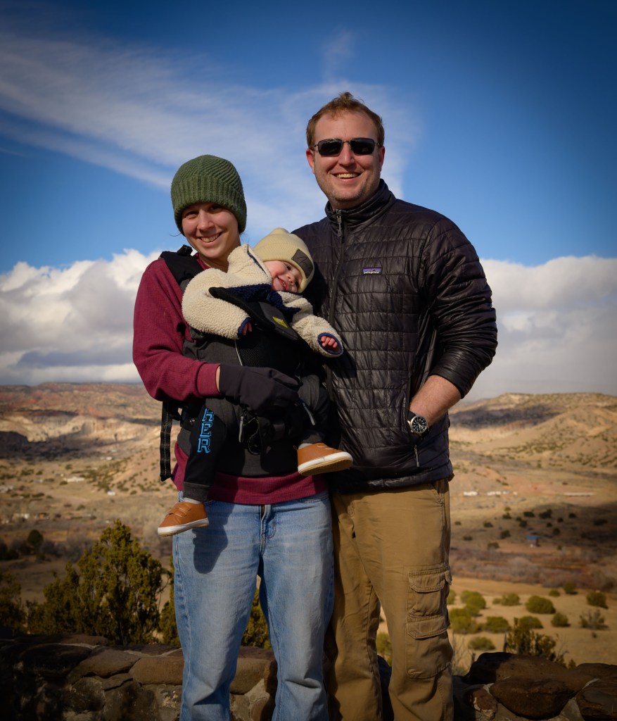
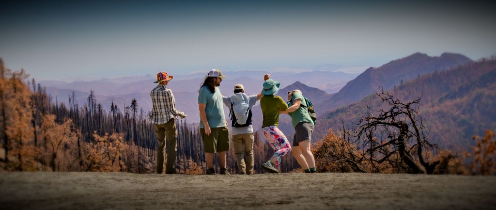
The dramatic scenery, penetrating yet rejuvenating wind, and caressing sunshine comprised about 90% of the trip’s joy. But, I have to tribute the human company for at least 10% of the contentment.
The other Joneses, the mystery man in black, and the photographer
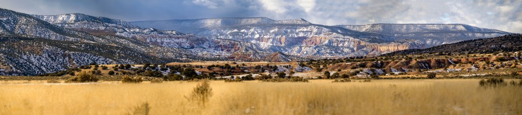
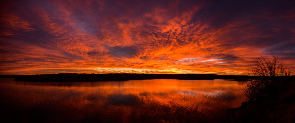
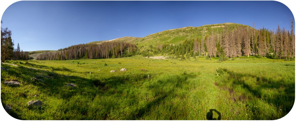
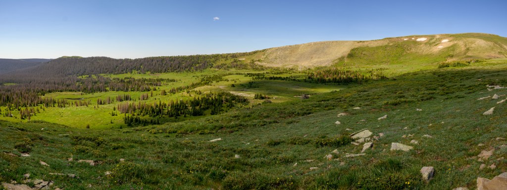
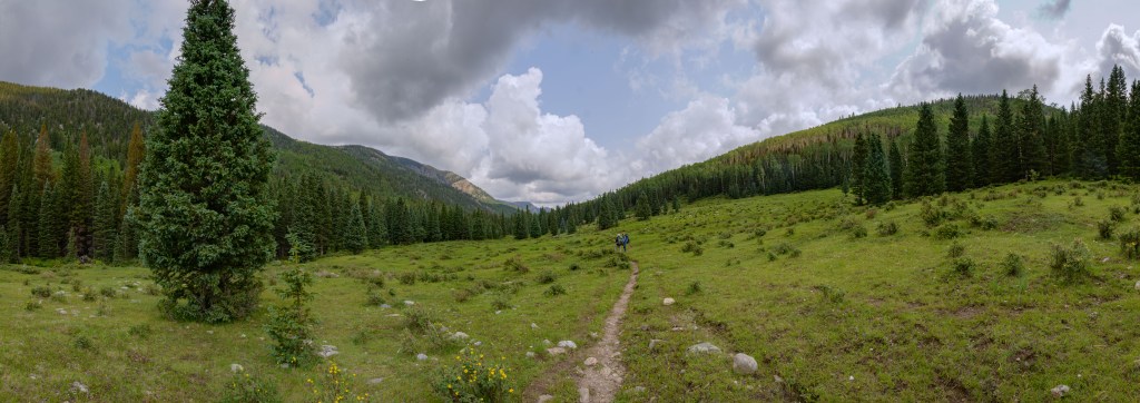
With that, I’ll leave you with one last panorama, one of my favorites out of the ~800 pictures I took on the trip.
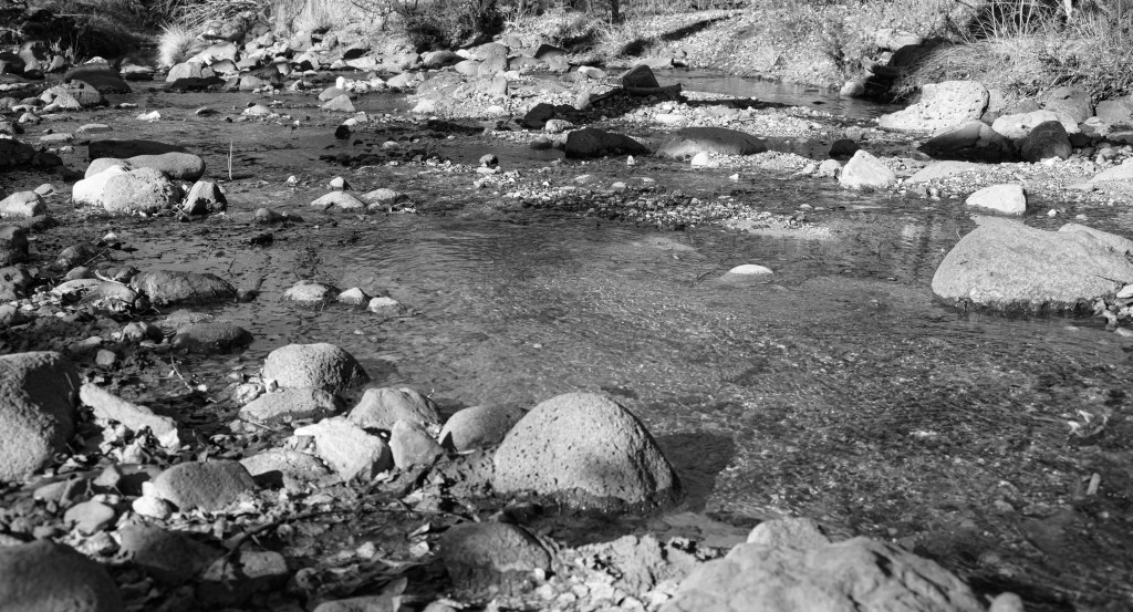
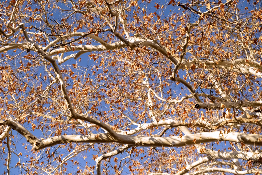
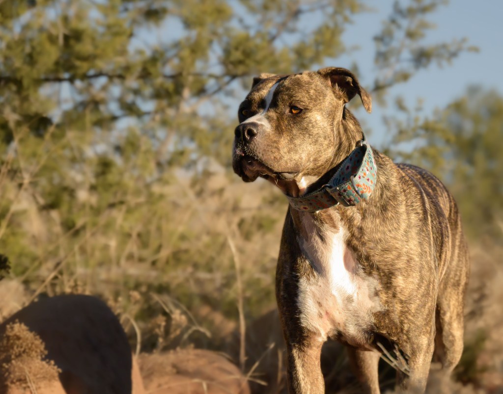
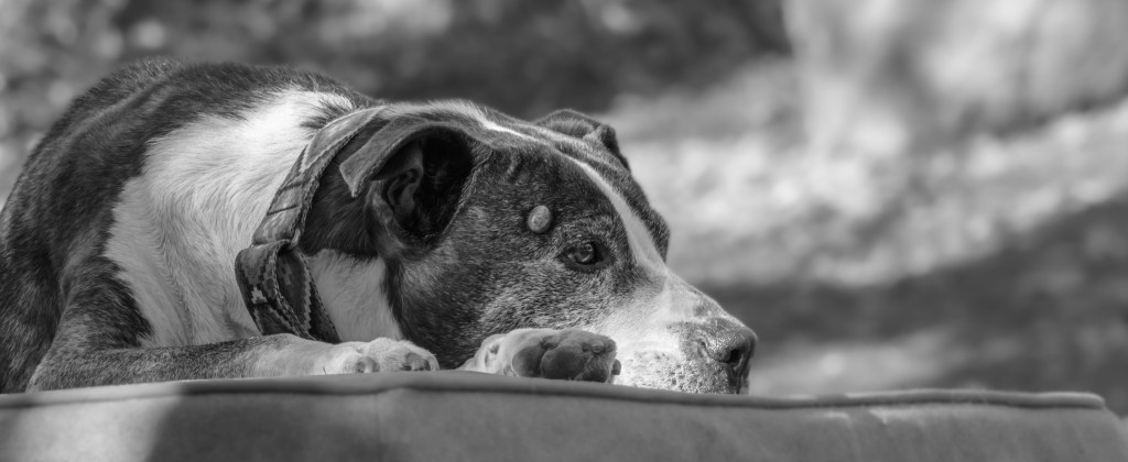
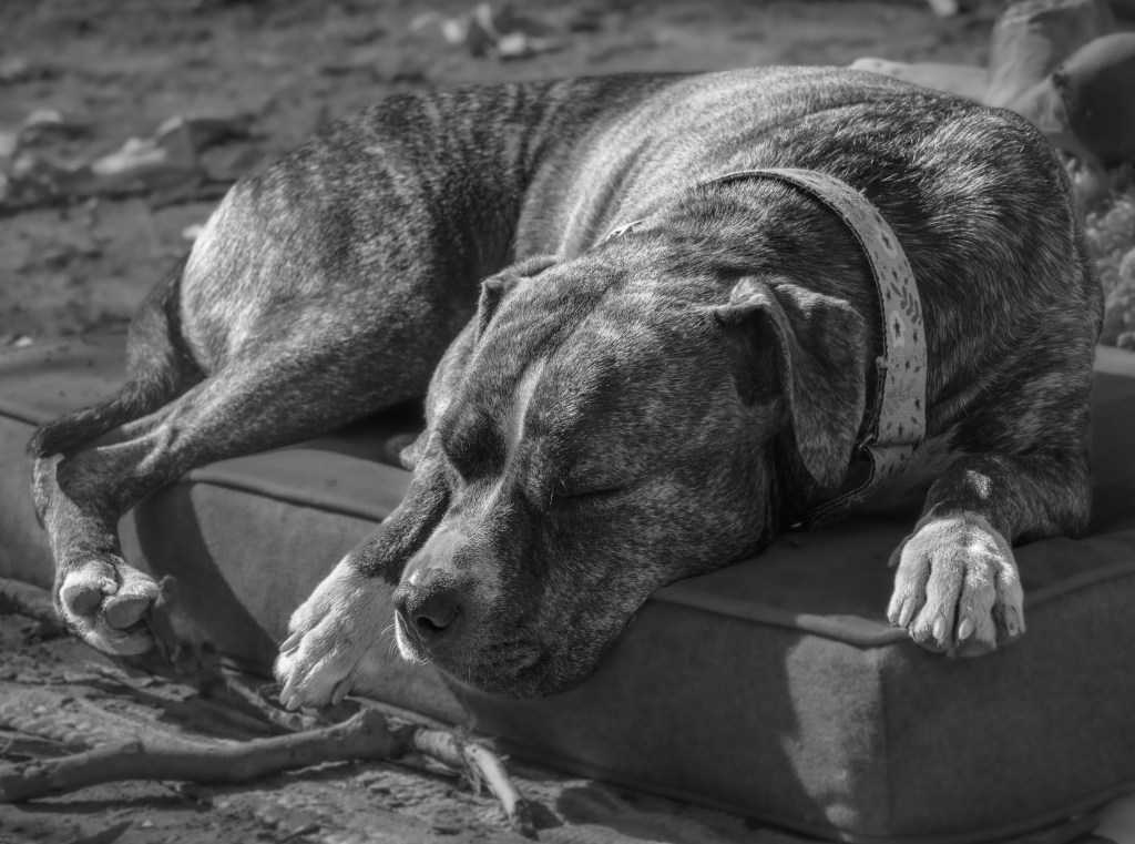
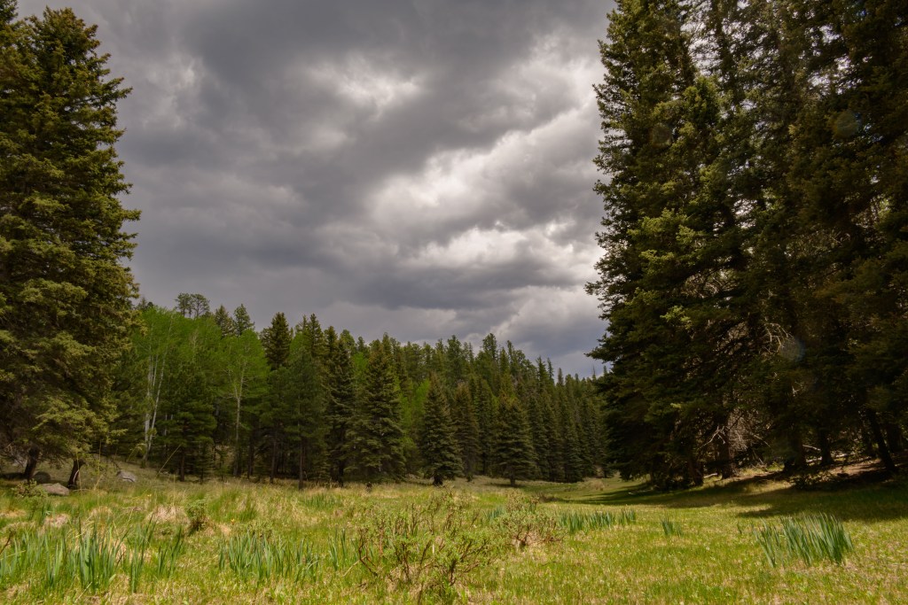
We headed down towards Sedona, AZ, with goals of 1/3 to give Althea a last good hike before 2 months of bedrest during heartworm treatment, 1/3 to give Perry some good sniffs in warm weather at lower elevation, and 1/3 for our 15 year wedding anniversary. After looking at dispersed camping in the area, I chose an area around FR 618 south of Sedona as the lowest elevation / warmest area. We found a fantastic spot to park our van down by the river (ok, it was a small creek, but I’m not arguing with running water!) and under some beautiful white-bark trees which I think are American Sycamore.
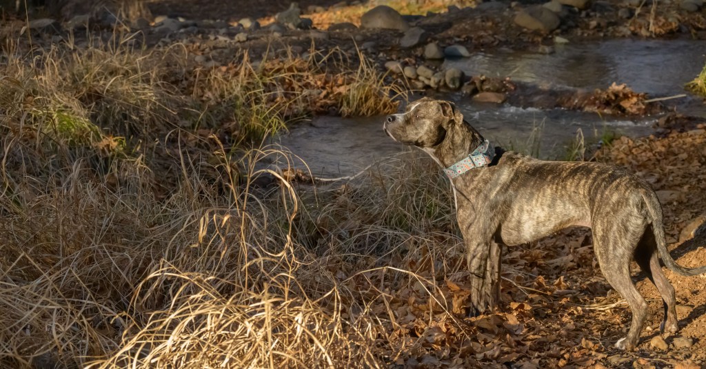
It was overall a relaxing trip, reading and knitting at the campsite with Perry in the morning and taking Althea on some shorter hikes in the afternoon.
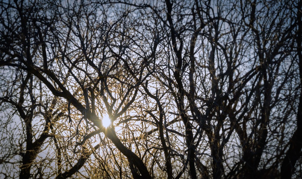
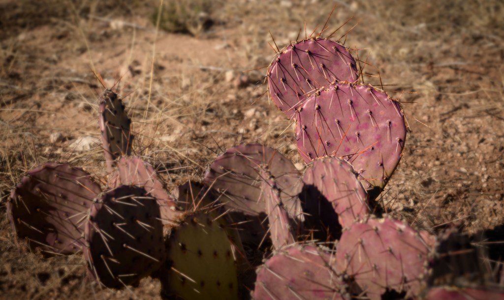
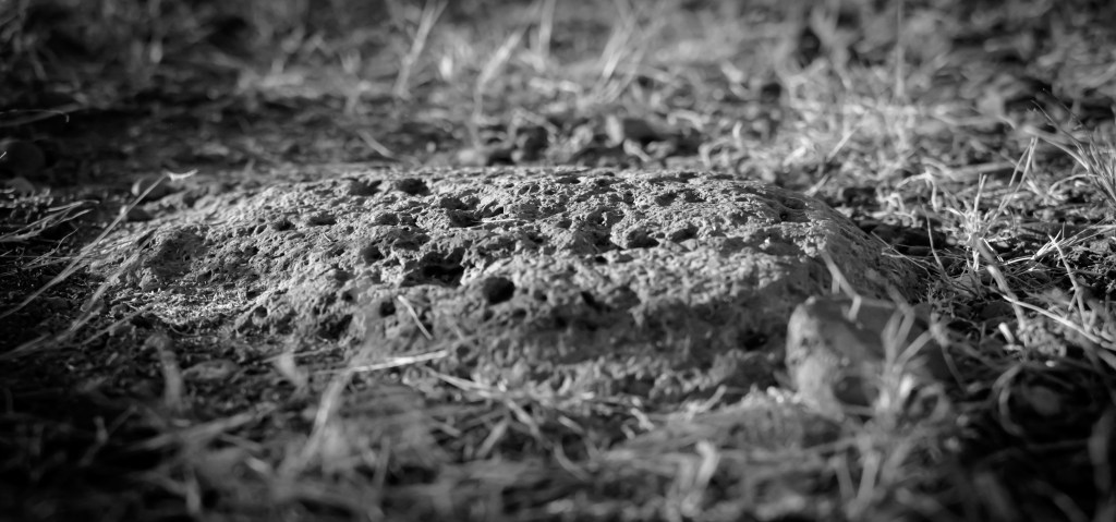
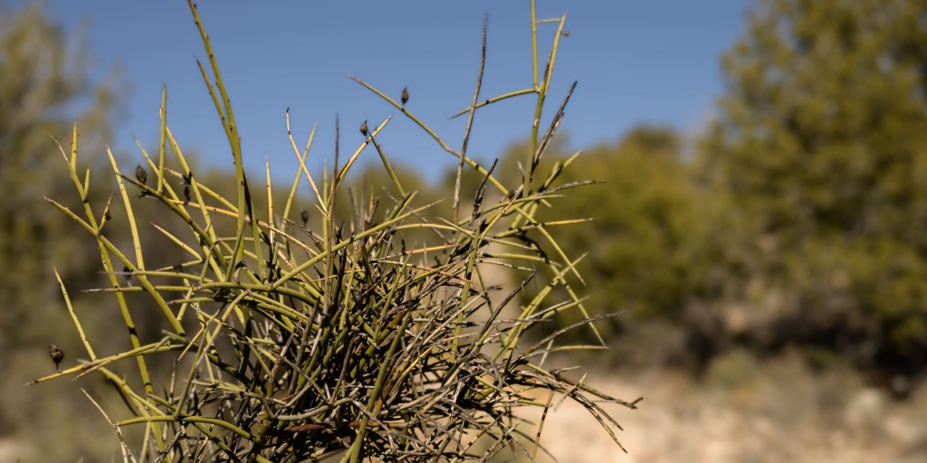
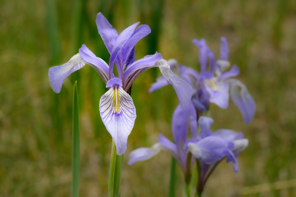
Instead of breathtaking vistas, I tried my hand at capturing the smaller details of our hikes.
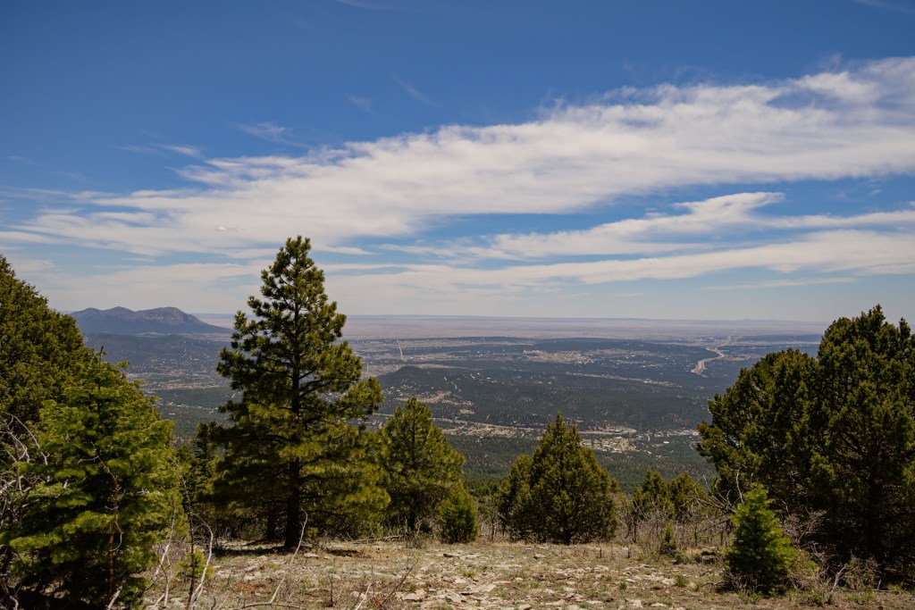
At the end of the trip, we met our goals with two tired puppies.
As anyone who knows me knows, I am not a night owl. Things in the night sky might be cool to look at, I don’t argue there, but is it really worth getting out of bed after 9 pm? And being cold for? Most of the time, not so for me, but camping is a caveat, since I’m probably going outside to pee anyway sometime during the night. Might as well try to take some photos, eh? Given my level of enthusiasm and dedication to the art of astrophotography, I haven’t had much practice and these are far from stellar shots, but I think I found a couple worth sharing at least.
These first two are from an ill-fated camping trip to Lincoln National Forest, near White Mountain Wilderness. M— and I took Perry and Althea down for the weekend, but spent all of Saturday dealing with a broken suspension on the van after hitting a rock just right. Luckily, we had backup friends who were coming down anyway, who brought some jacks and jack stands with them. Combining those tools with an adjustable crescent wrench a nice local on a 4-wheeler gave us, we actually managed to get the wheel unjammed from the wheelwell. While we missed the entire day of hiking we had planned, you couldn’t have asked for a more pleasant ambiance for a catastrophe. We stayed the second night with the rescue friends, when I got the two photos below.
Lincoln National Forest, Aug 2022
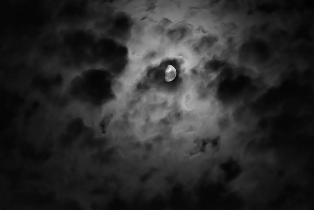
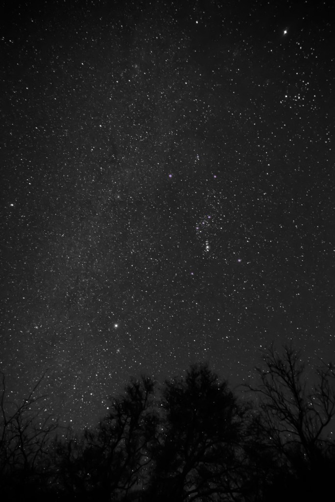
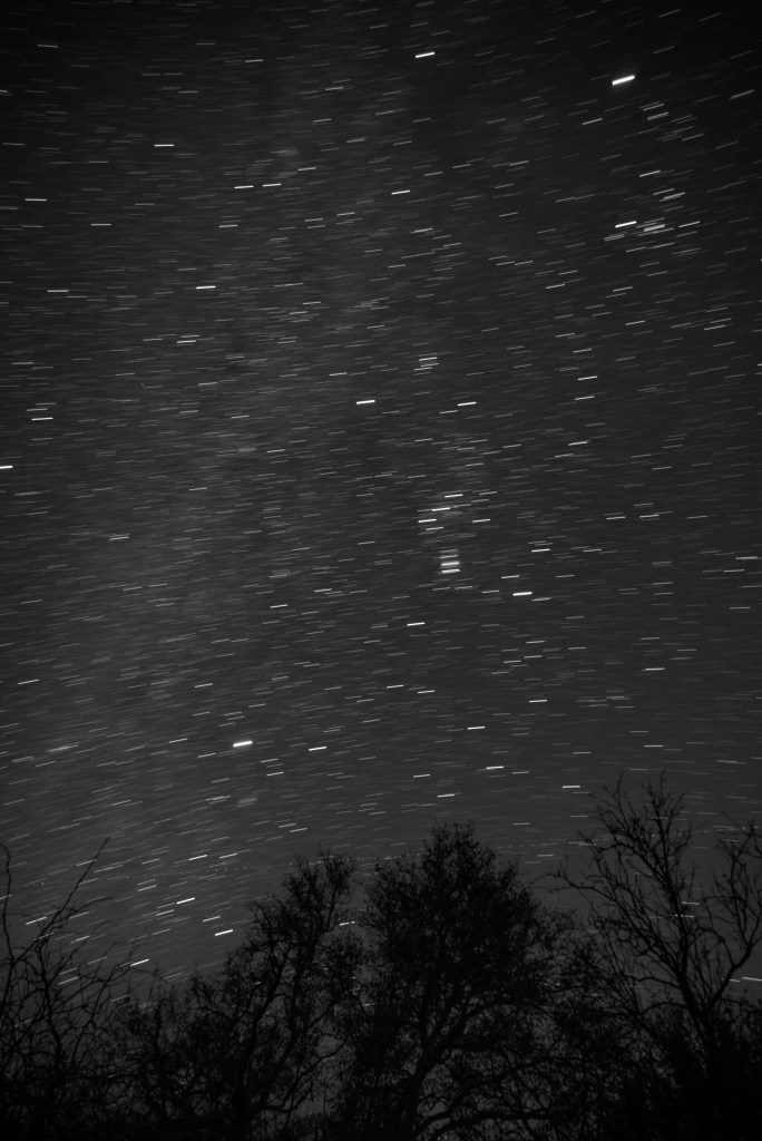
After promising to practice nighttime photography at home, and failing utterly, I went ahead and tried again on another camping trip south of Sedona. This time, I was up with an upset stomach digging cat-holes three times a night, but the weather was mild and I went ahead and got the camera out one of the times I was up anyway. I played around with the focus (turns out the camera will somehow go a little past infinity, to the detriment of the photo) and the trade off between ISO and exposure time. (Preliminary conclusion 1—if you want a sharp image, you need a shorter exposure time than I’d have guessed to avoid motion blur of the stars. 10 s with ISO 4000 and heavy denoising in CameraRaw later worked decently.) I also gave an initial attempt at long exposures to capture the star sweeps. (Preliminary conclusion 2—if you want long enough trails to look purposeful, you need a longer exposure time than I had patience for; I found 309 s as a lower bound.)
f/4, 10s, ISO 4000, Dec 23, 2022, 11:47pmf/4, 309s, ISO 400, Dec 23, 2022, 11:43pmCoconino National Forest, south of Sedona, AZ, Dec 2022. Can you find Orion? He’s my favorite guy in the sky.
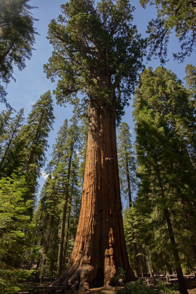
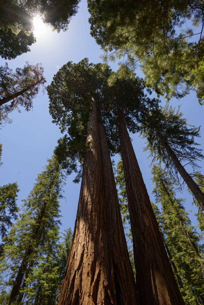
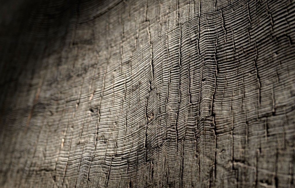
The giant sequoias in Sequoia National Park are amazing to see in person. The photos simply don’t do them justice, especially without a scale bar, but I tried to capture some anyway.
Giant sequoias in Sequoia National Park, CA. A couple of views straight-on and looking up, trying to capture some of their majesty.
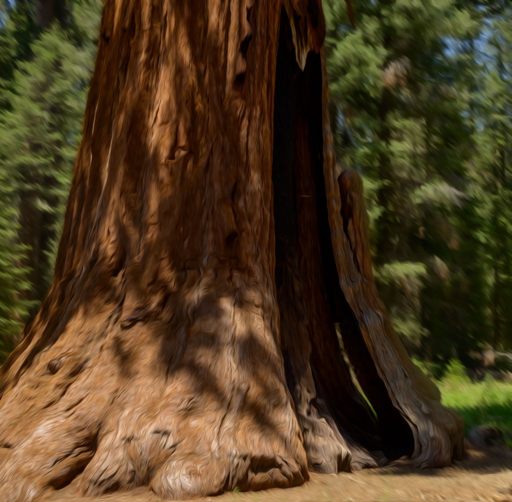
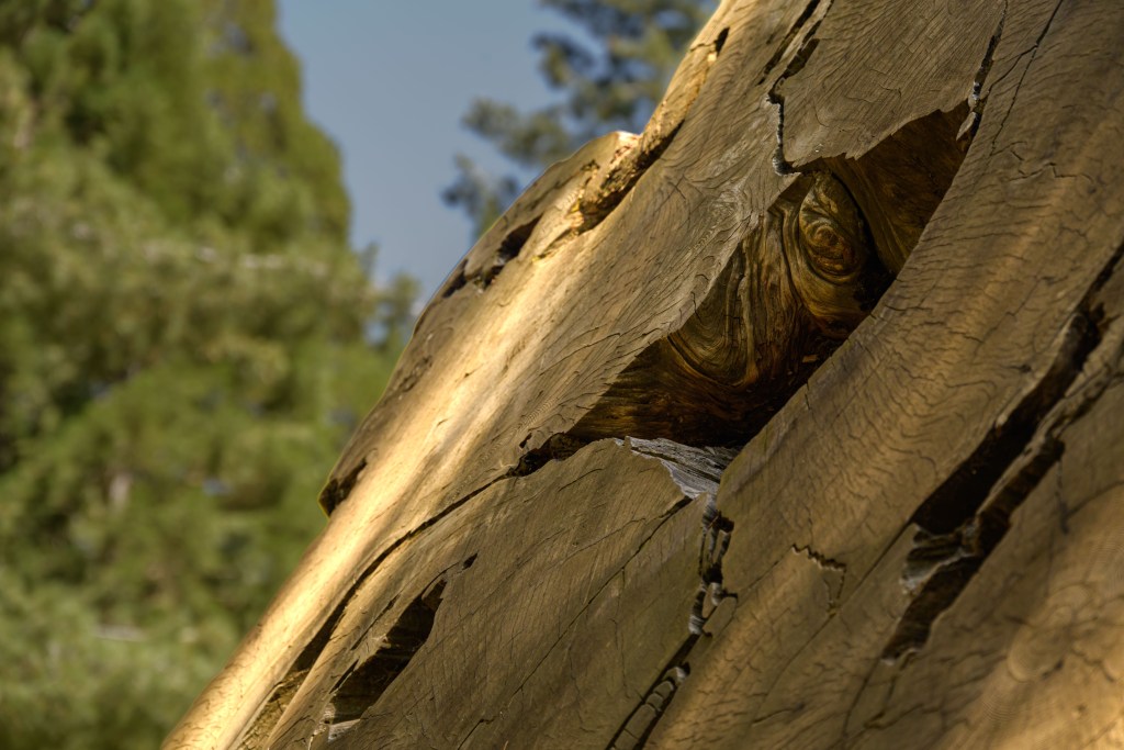
Instead of always looking up, sometimes it’s nice to look them straight in the eye.
Looking the sequoias in the eye. On the left, I tried the “oil painting” filter just for fun. On the right, I think this guy is “peeking” at you through the other trees, which is a ludicrous idea for such a large tree, which is why I like this photo.
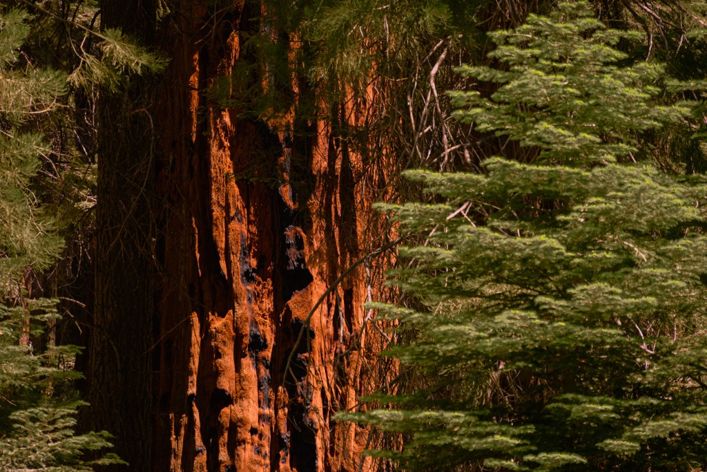
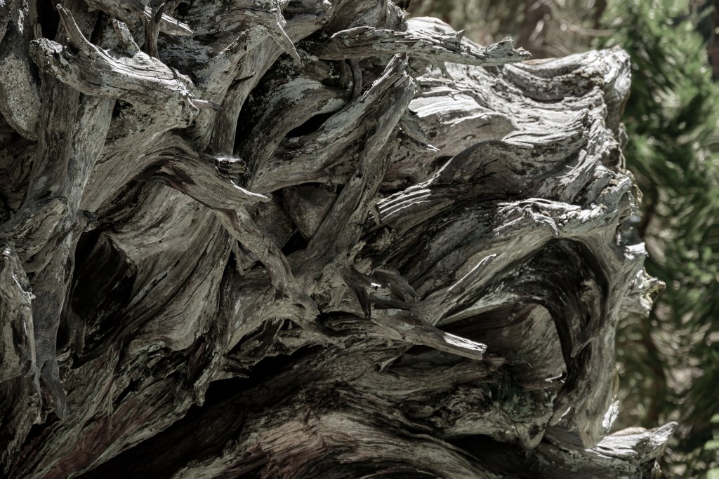
After failing to really portray the sense of the trees through the photos, I switched to some more artistic angles of them. I especially like the one on the left showing all the rings. If you stop and think about what you’re looking at, the rings almost convey the spirit of the trees better than pictures of the trees themselves.
Trunk and root ball of the sequoias.
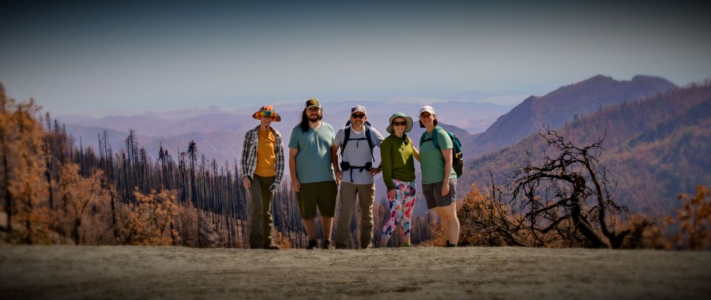
Unrelated to the Sequoias proper, we went on a hike and fell off a cliff!
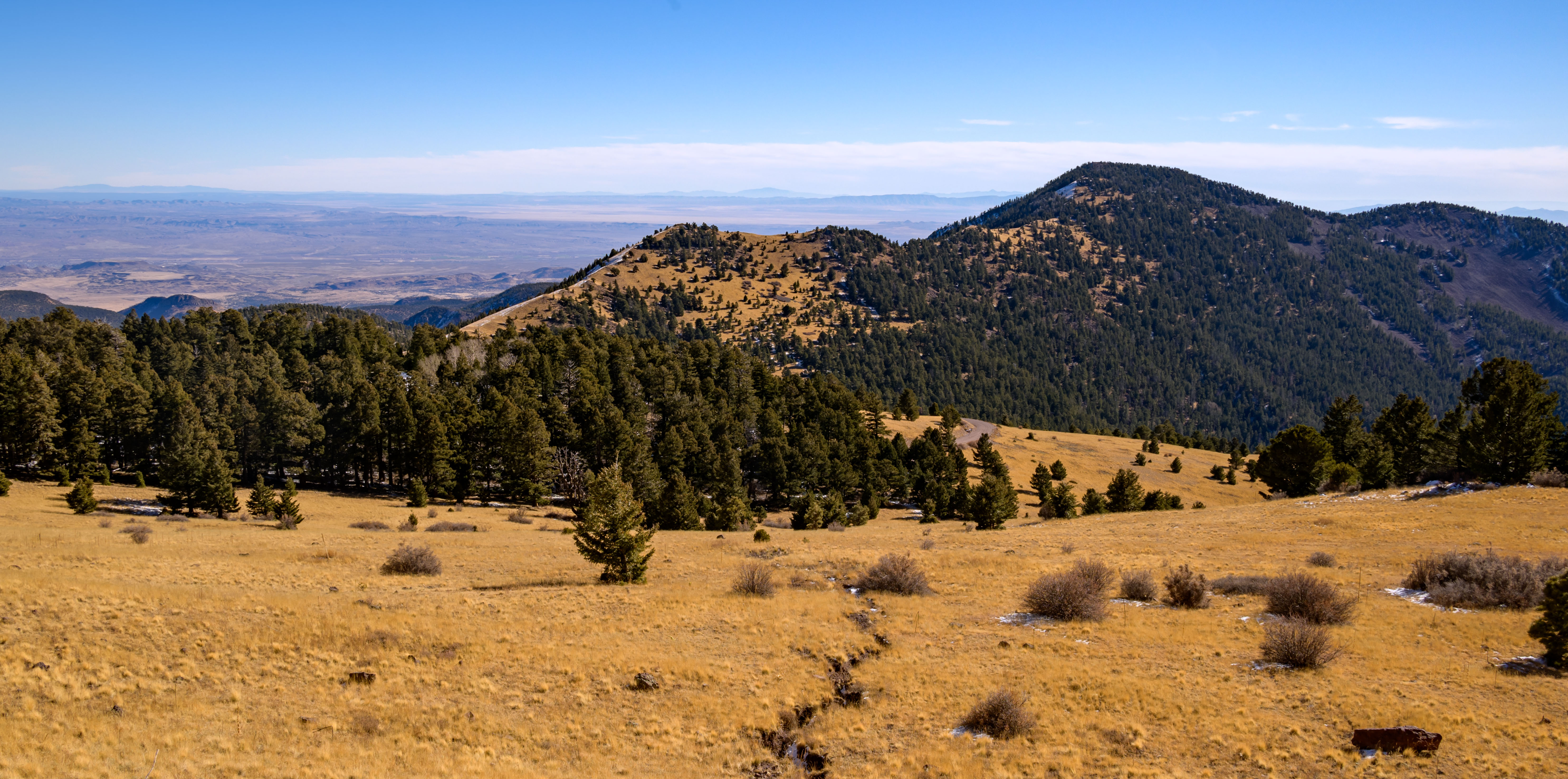
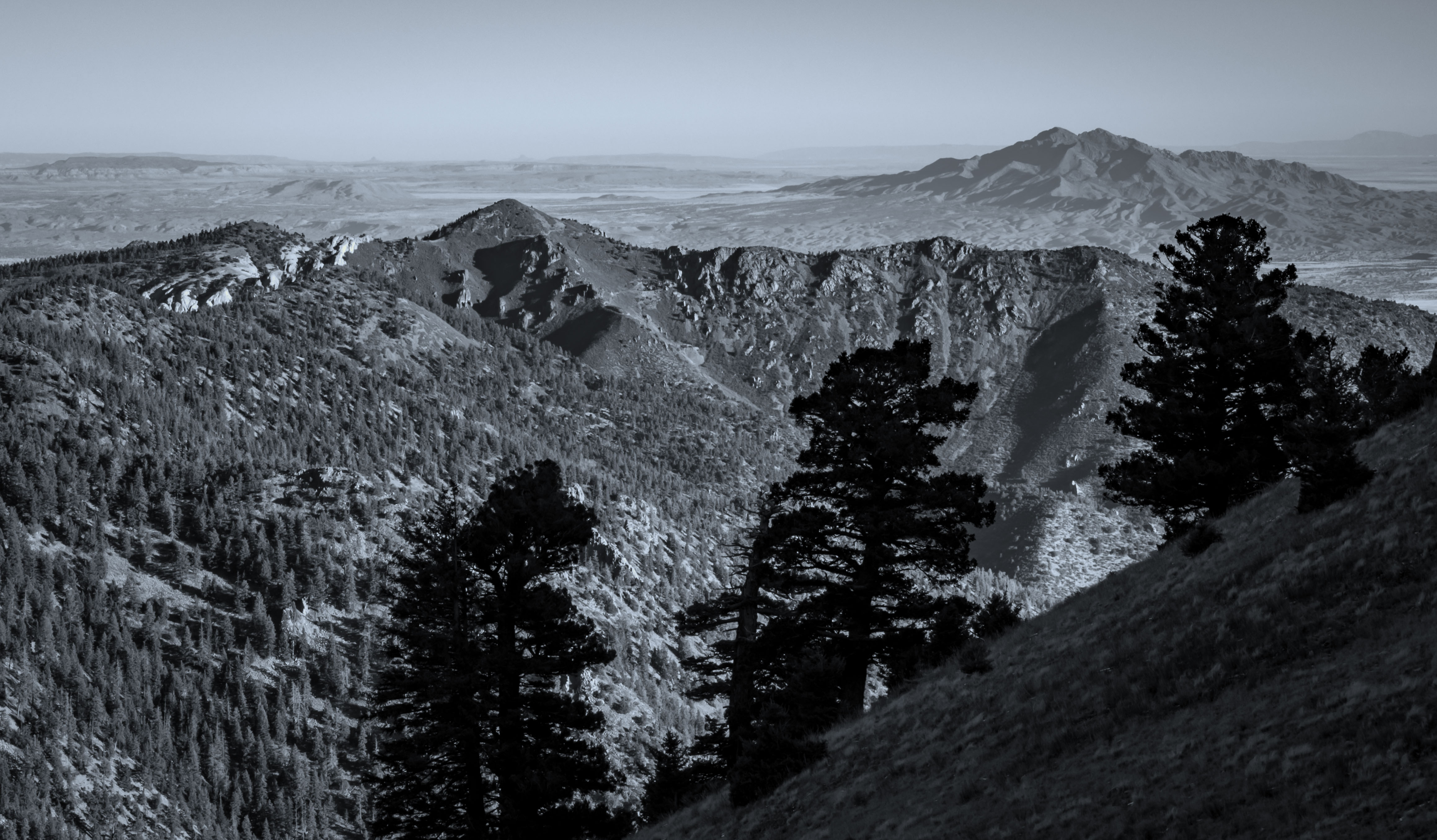
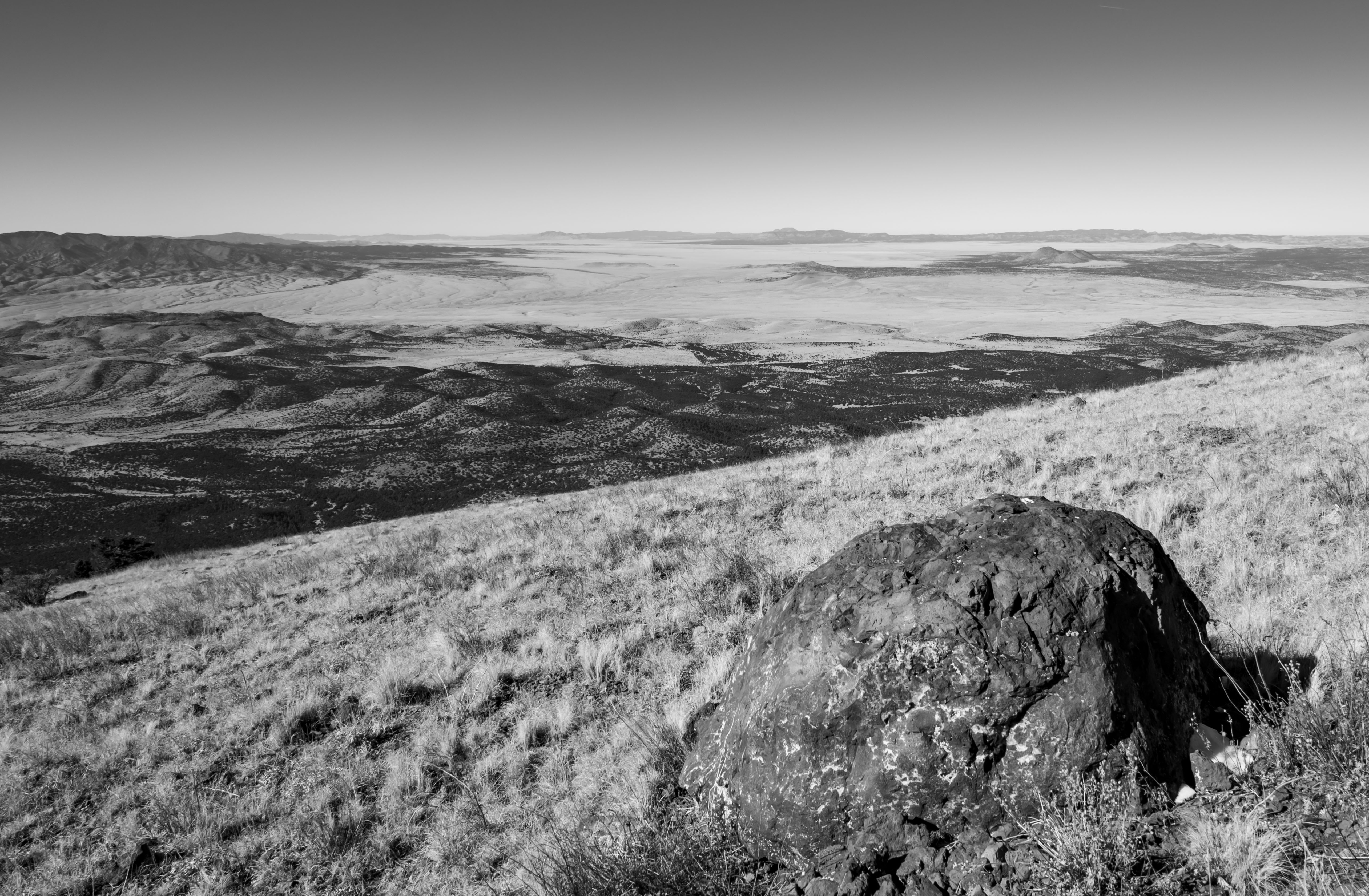
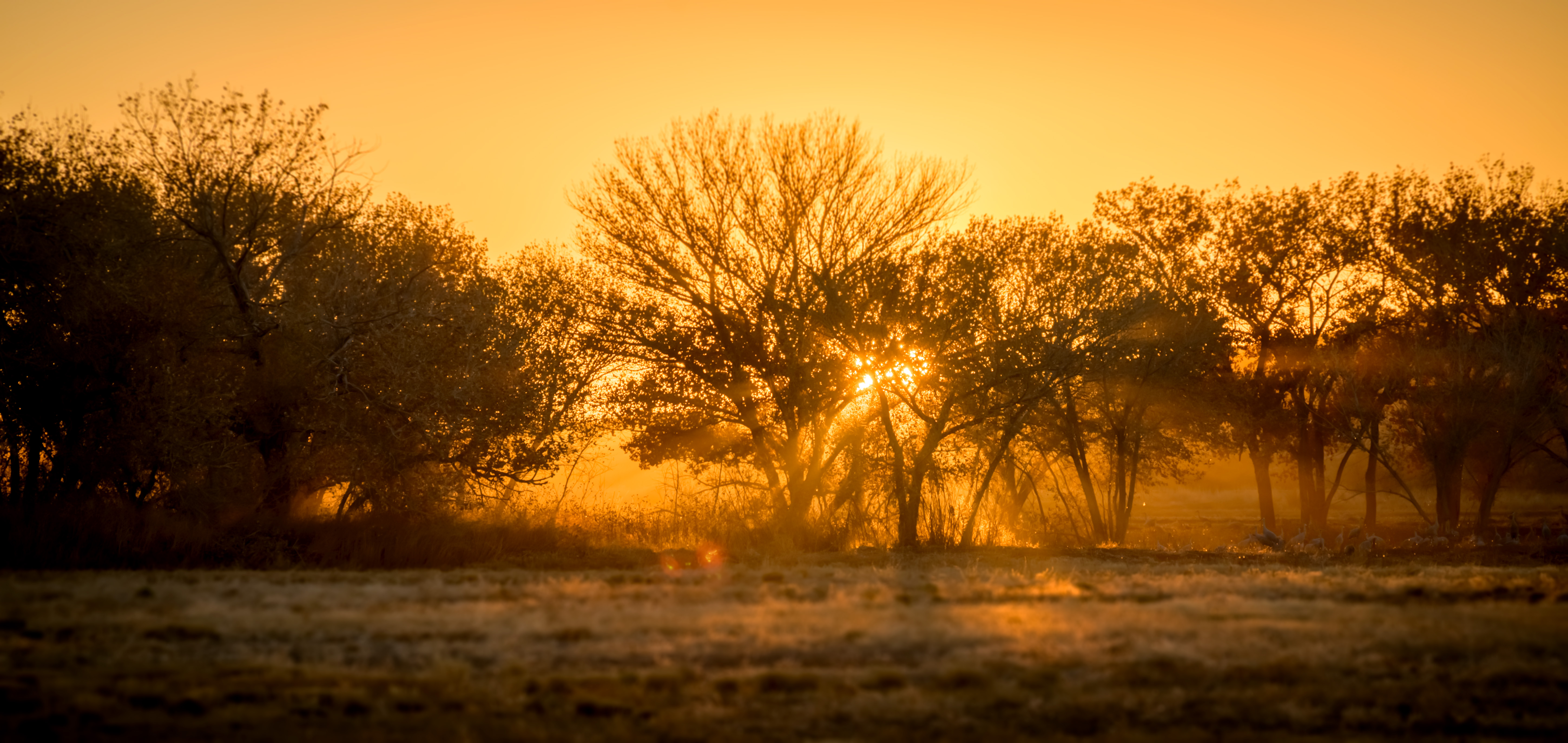
Hercules and I did a quick Big Blue trip down to the Cibola National Forest between Socorro and Magdalena after Thanksgiving. Here are some pics I took as we drove up Water Canyon Road. The view changed at every hairpin turn as both we and the sun climbed higher — a fascinating evolution to observe.
Up near the top, we parked and walked towards South Baldy. The views were expansive (though not as sweet as they are when they’re earned after a hike instead of freebies accessed from the car). Here’s one that’s looking out towards the VLA.
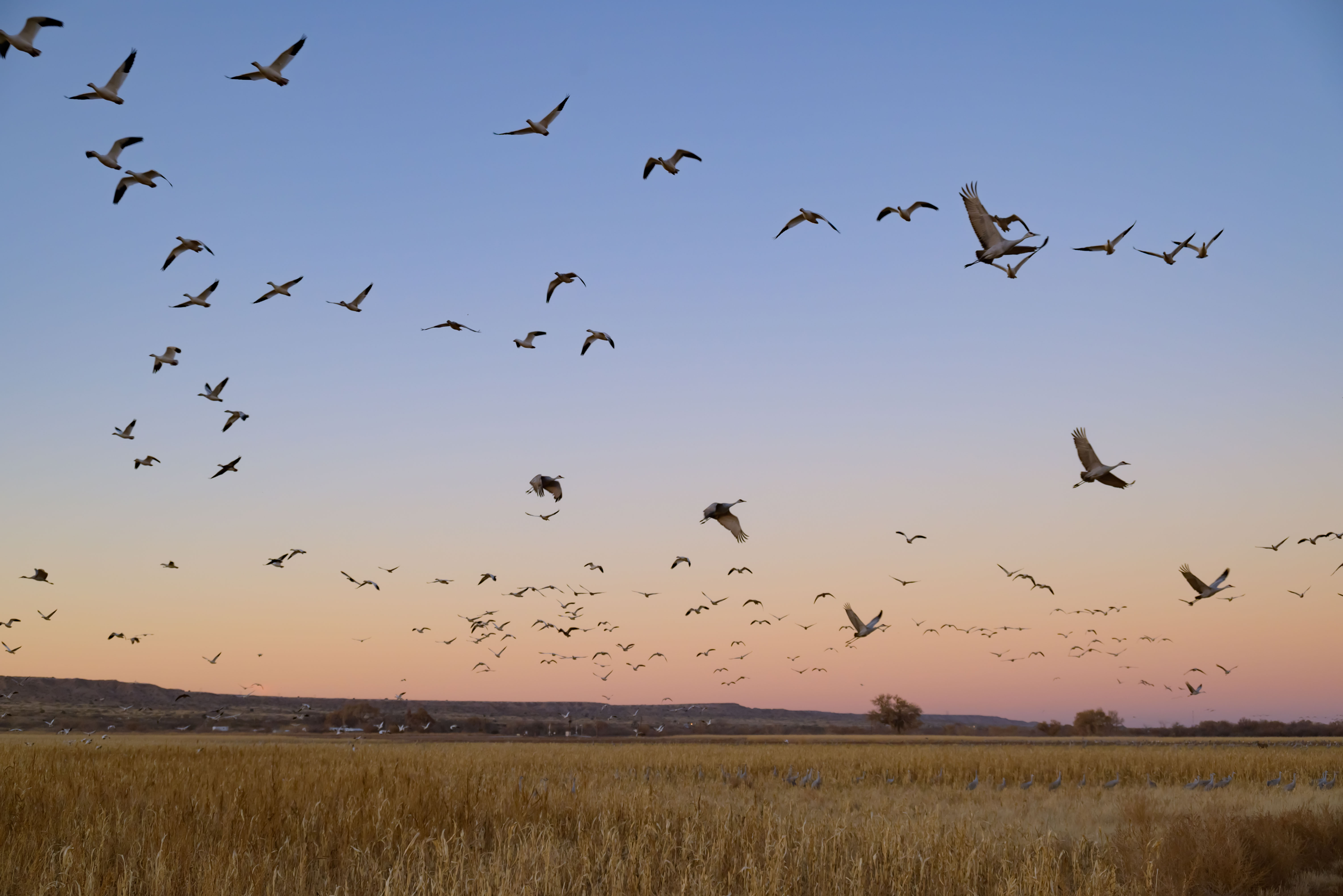
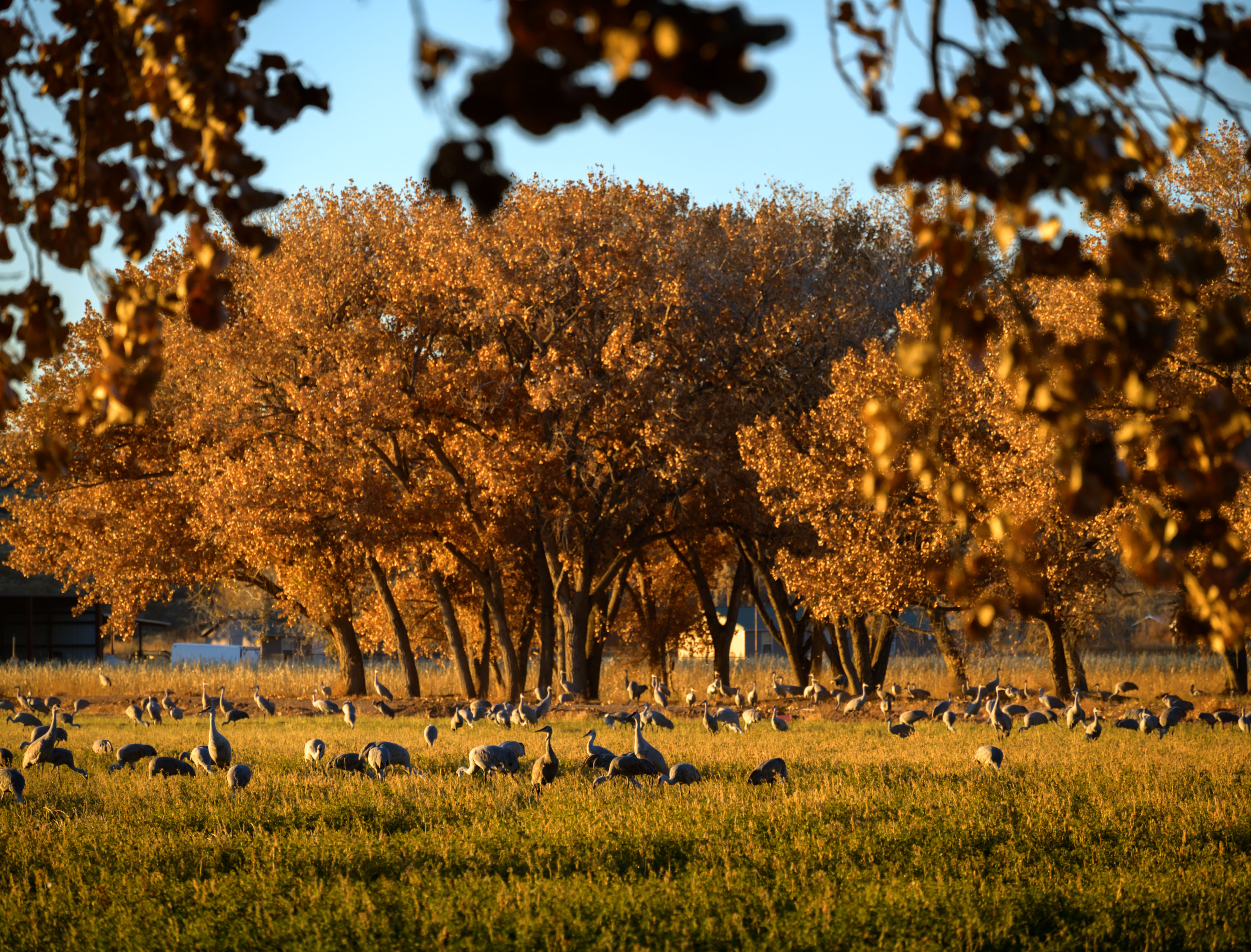
After a nervous drive back down the icy/snowy/cliffy forest road, we swung by Bernardo Waterfowl area upon J-‘s suggestion to see the Sandhill cranes that stop by there on their migratory route. That was a pretty special scene — hundreds and hundreds of birds all eating from the corn and alfalfa that was planted for them at the refuge and singing the song of their people.
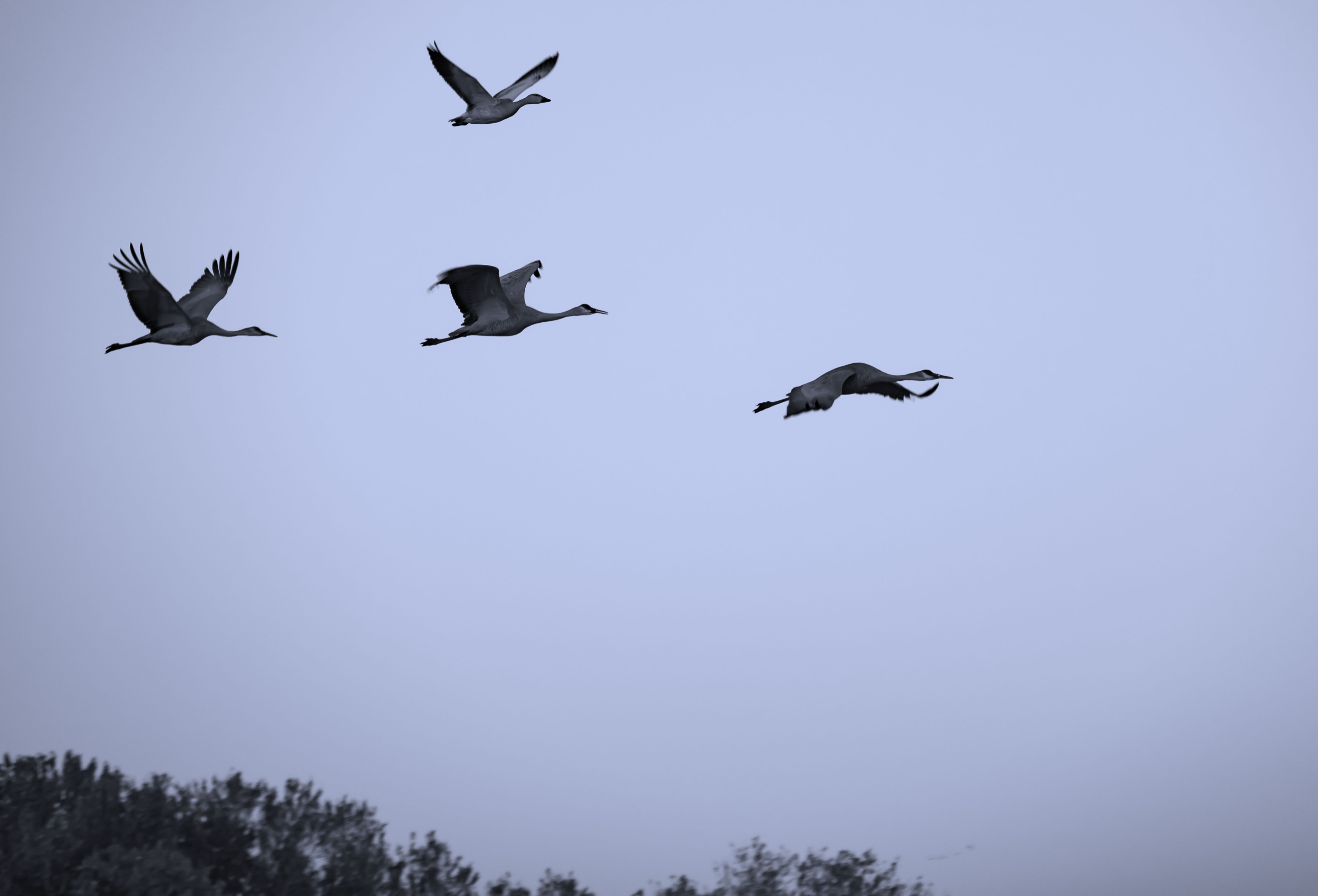
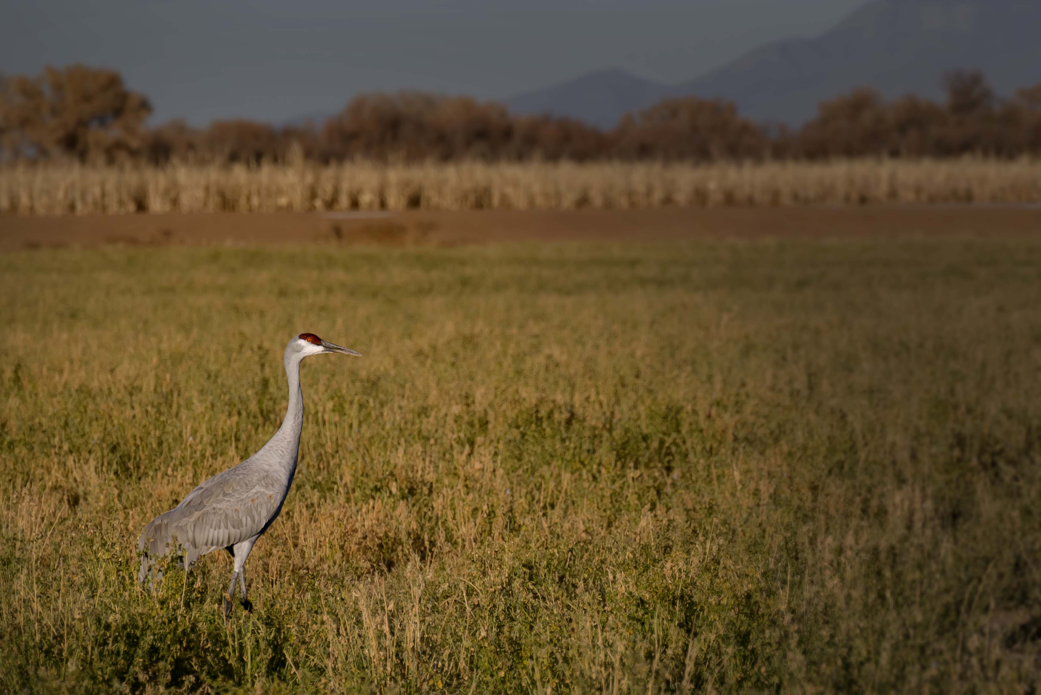
I mostly watched and absorbed, but I went ahead and tried my hand with some photos, too. I felt a little silly out there with my wee little 200 mm lens amongst folks with gigantic telephoto lenses. This was also my first time trying to freeze animal motion, and the images make it clear that I need more practice! Still, if you don’t look too closely at them, I like them.
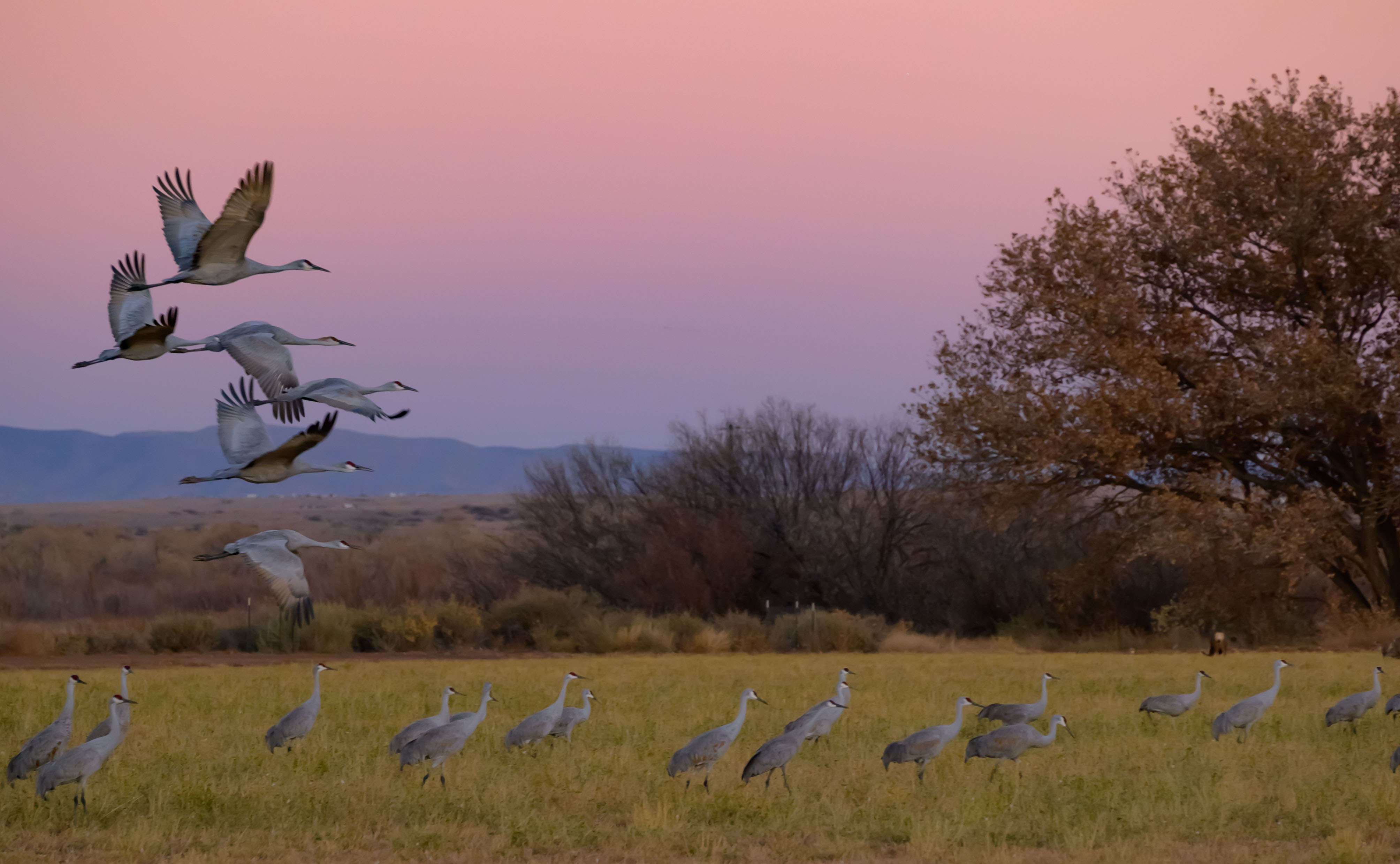
Dawn and dusk are the best times, I was told, to see the cranes, so I also got distracted a little by capturing the sunset.
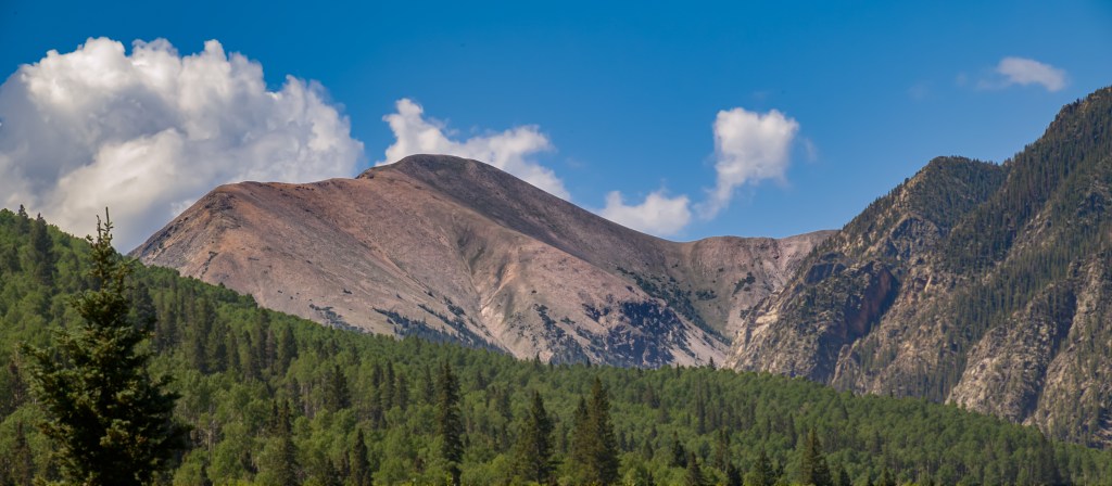
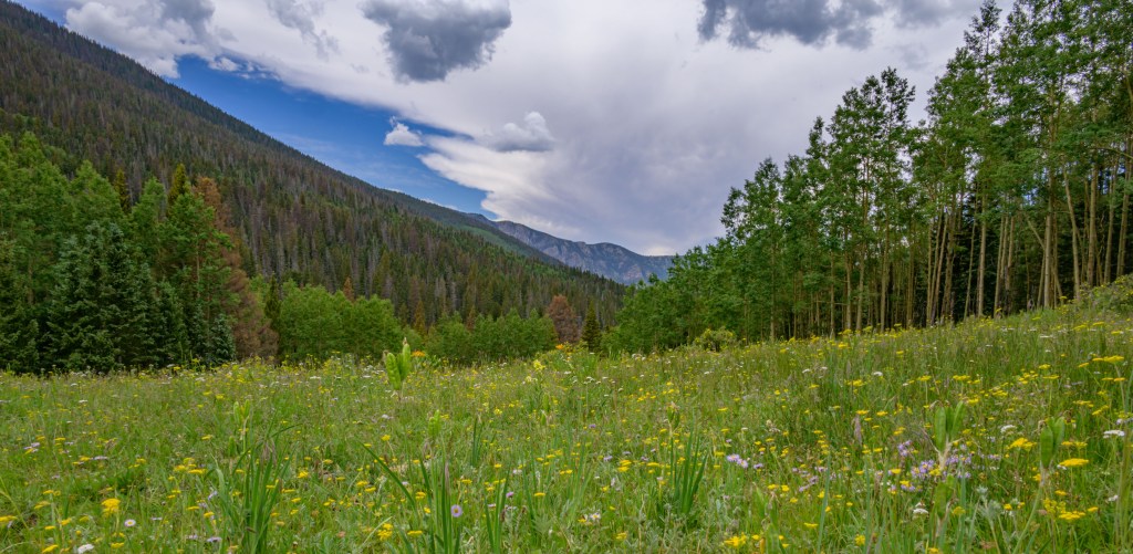
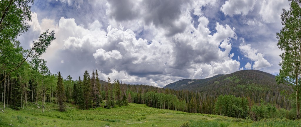
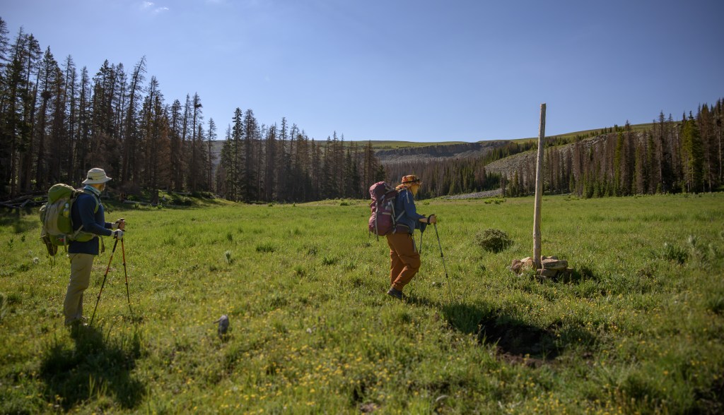
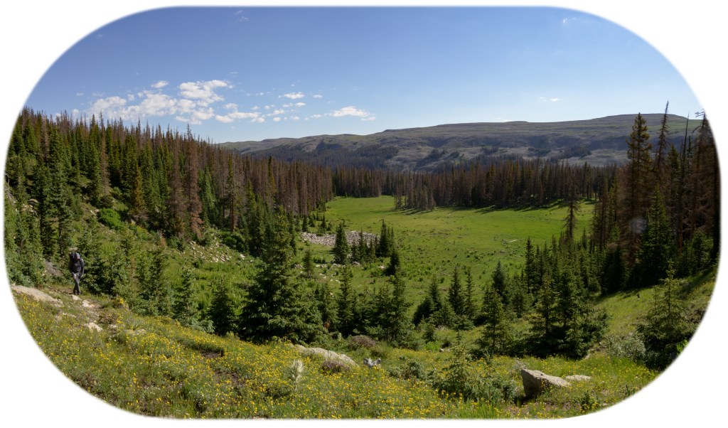
We headed out into the Pecos Wilderness for what has become something of a birthday backpacking tradition over the last couple of years. This year, we headed up the East Fork of the Santa Barbara trail, camping just below the ridge line. Day two was spent hiking along the ridge to the west, and on Day 3, we strolled down the West Fork. Check out this map for some route context. (P.S. If you’ve never explored Caltopo, you should check it out. I can spend hours on this site, planning out my next adventure. I love maps!)
Hiking along the Divide trail last year, specifically the stretch between Jicarita peak and the East Fork, was the final motivation to buy my camera, so of course, I was super excited to haul a couple extra pounds 3,000 feet up the mountain for this trip. Finally, 3 months later, I’ve finished the photo edits. You tell me if it all was worth it!
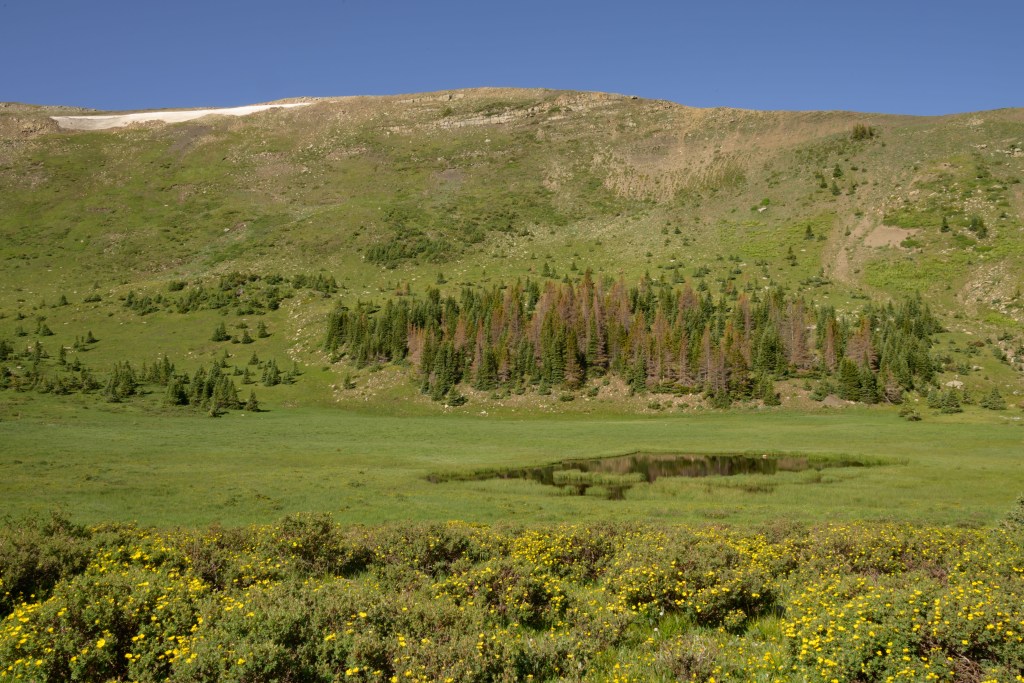
View of Chimayosos peak from the East Fork on our hike up on Day 1, and then a couple of views of meadows further up.
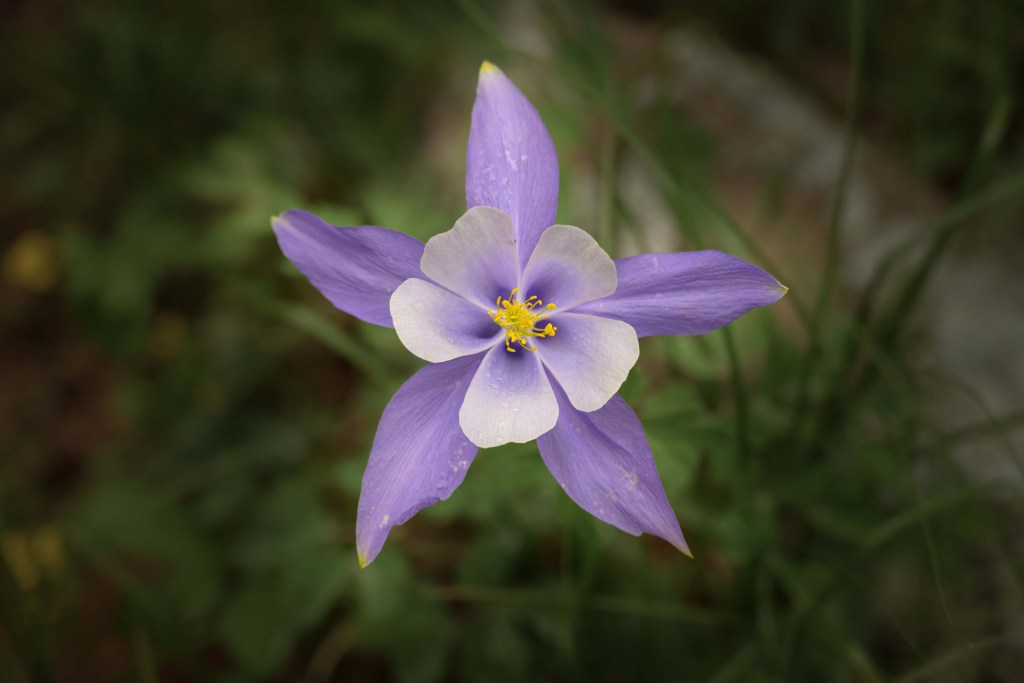
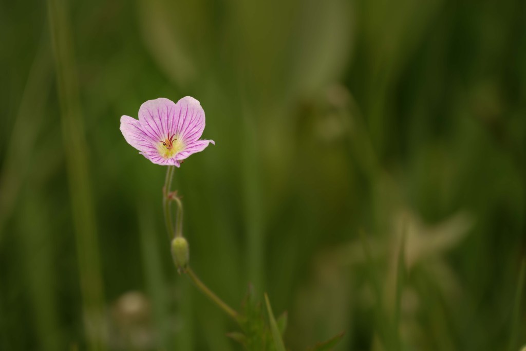
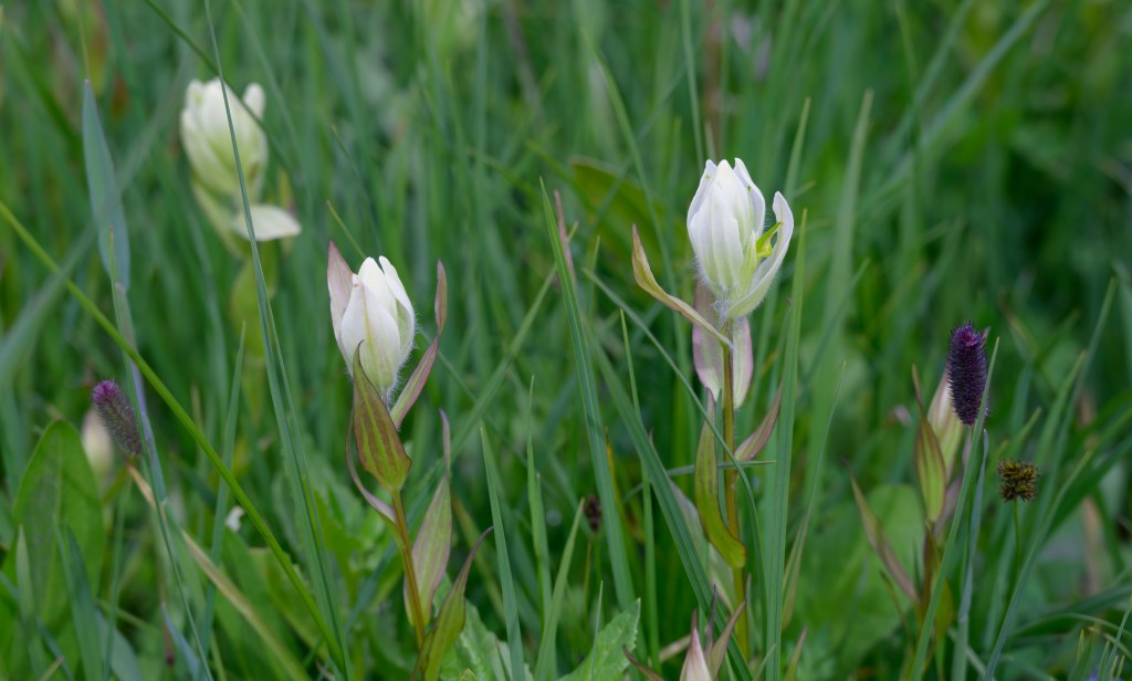
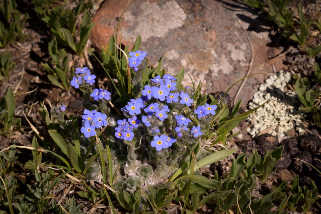
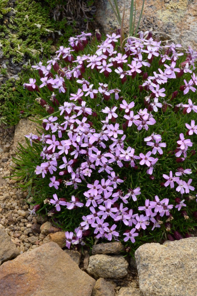
There were some beautiful wildflowers near our campsite Day 1, so I tried my hand at some closeups of them. I spent hours editing these photos, only for M- to like the originals better in several cases. Oh well. I learned some Photoshop tricks on the way that may be useful later on (if I can remember them). And in the end, whether or not you can tell a difference with the original or think these edits are actually improvements, I still think the flowers are pretty.
Wildflowers in meadow near campsite (and otherwise along the East Fork trail). Click on them to see the complete images individually.
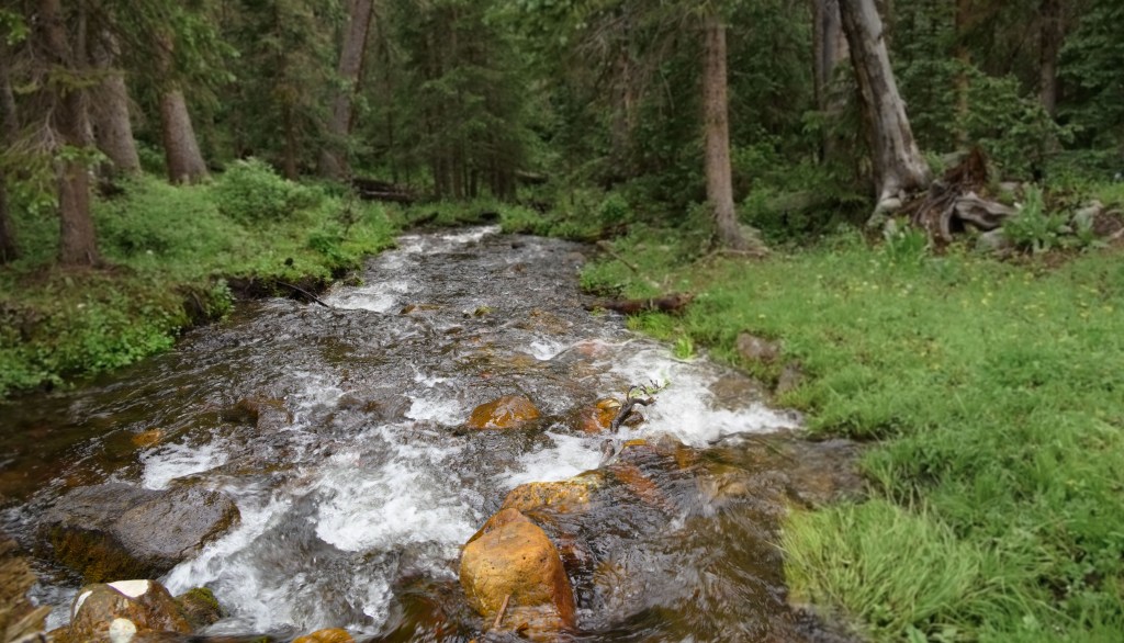
After hiking for miles through the cow-poo-filled marshy mucky-muck that was the East Fork trail, we stopped for the first night with several hours of daylight left, because we found a superb campsite by the stream and didn’t know what may or may not be further up the trail. That meant we got to enjoy some of the afternoon relaxing.
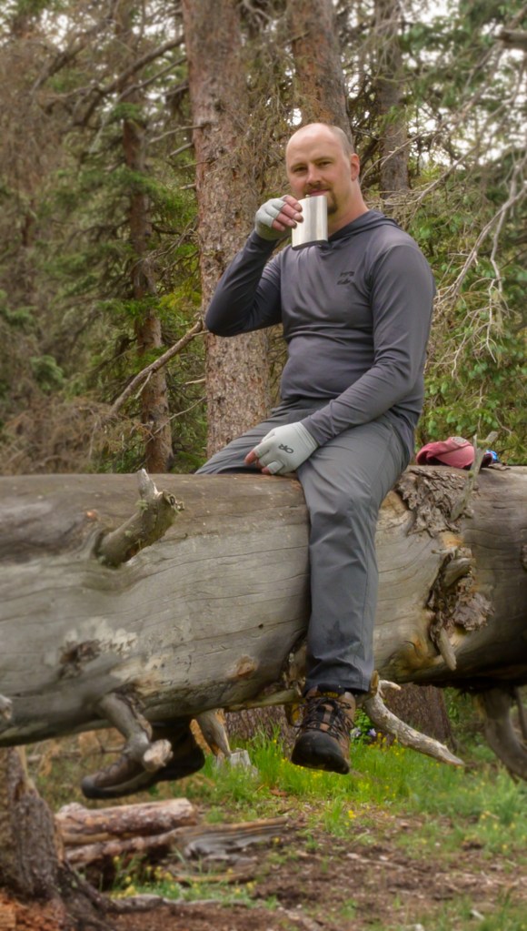
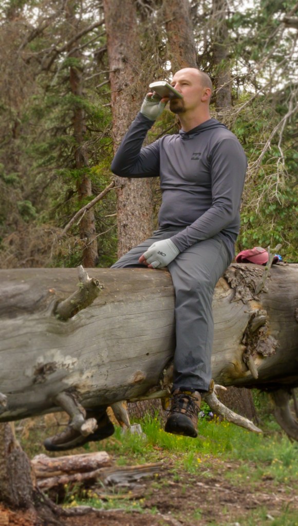
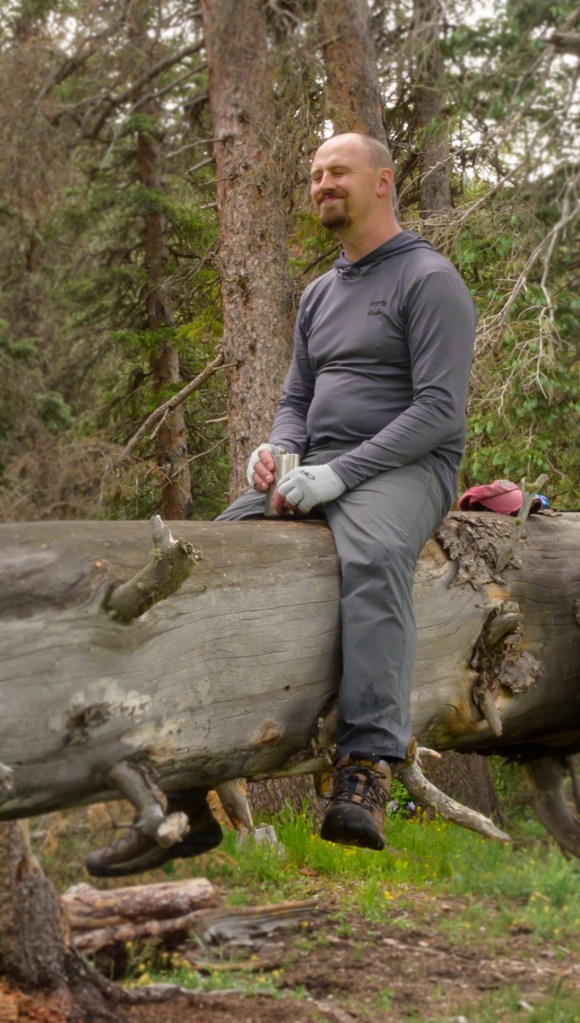
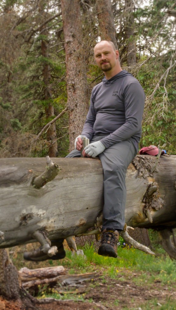
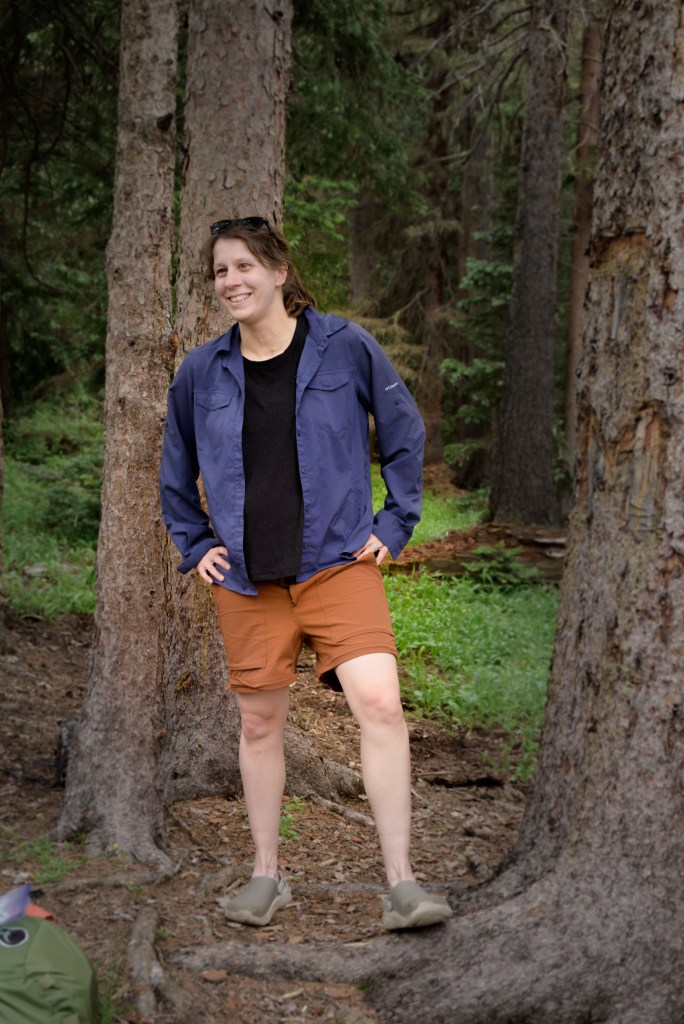
Drinking whiskey and filtering water—routine campsite activities out in the wilderness.
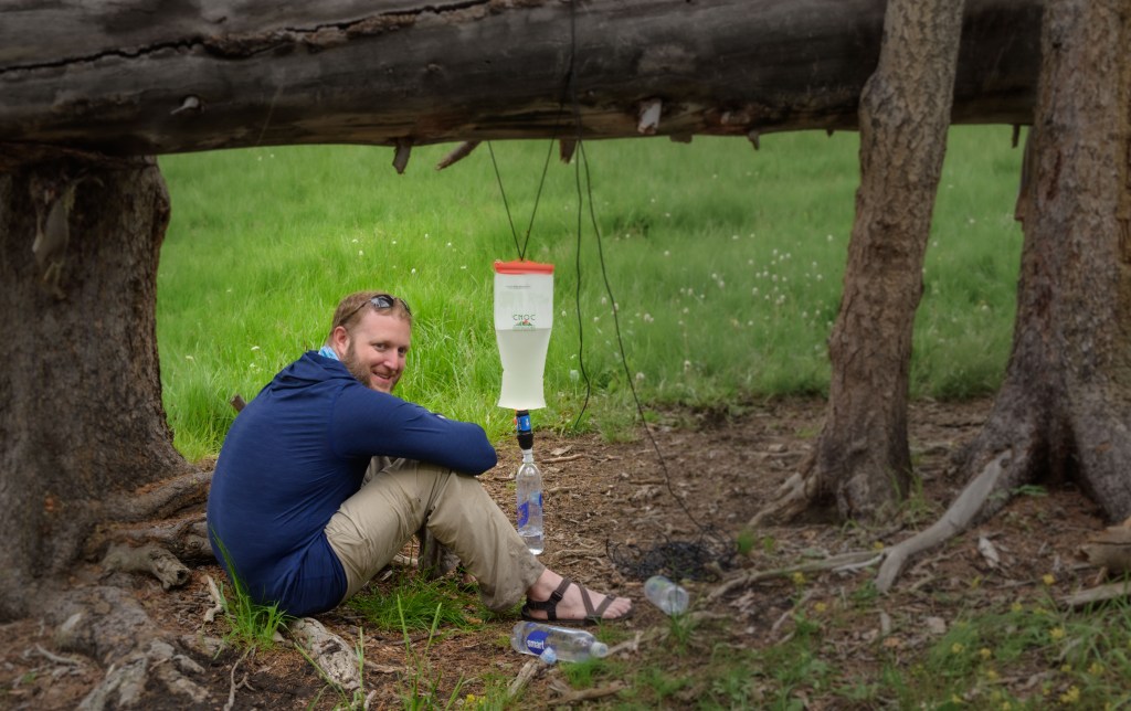
Water source (including bathing station) and the ubiquitous mountain west wildlife.
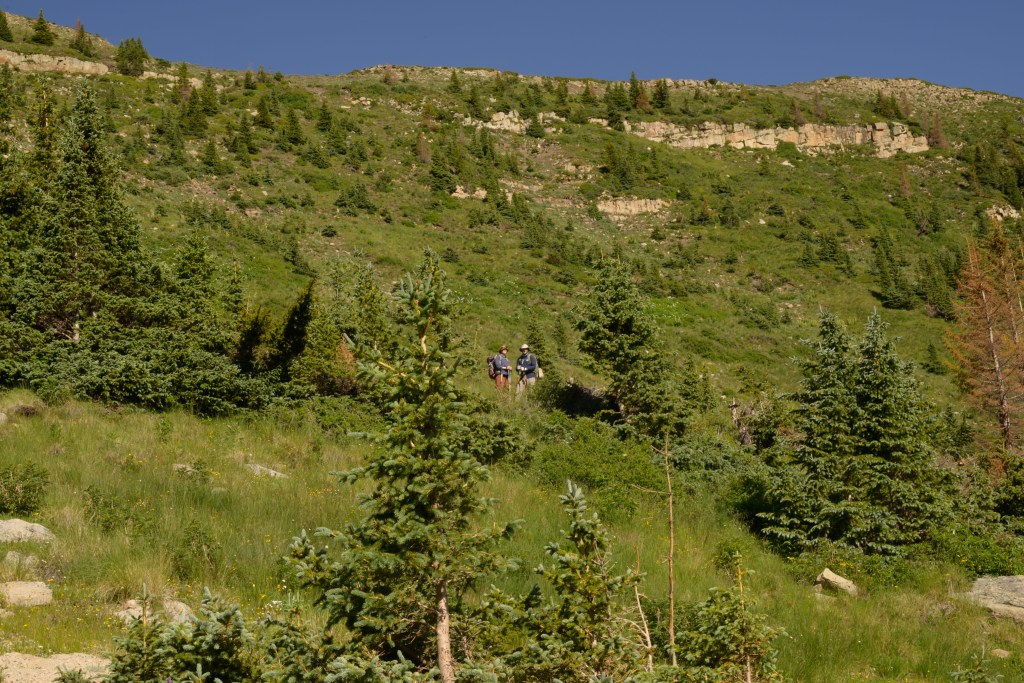
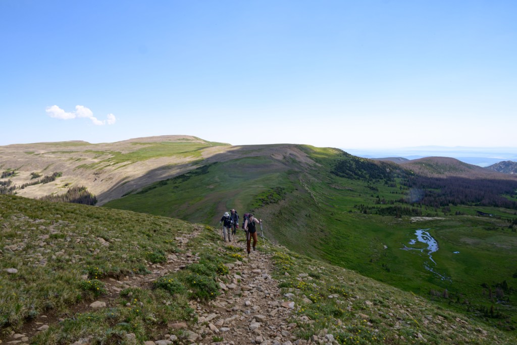
Morning of Day 2, we started the final push up to the ridge, which turned out to be a bit further and higher than we estimated when we stopped the night before.
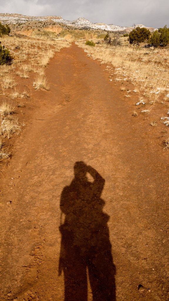
Photographer’s shadow
Connecting the cairns
Marshy meadow just below the ridge
Half way up, looking down
Half way up, looking up
Almost to the top
Coming up the last incline of the East Fork trail
Slogging up the final bit of the East Fork trail to the ridgeline.
When we made it up to the top, though, the views were every bit as vast and mesmerizing as we anticipated.
It looks flat here, but it isn’t
Staying strong at the false summit
Looking down the south side
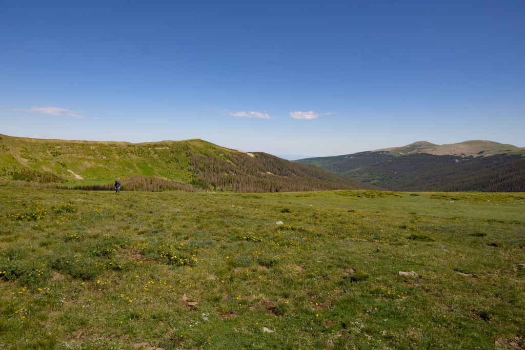
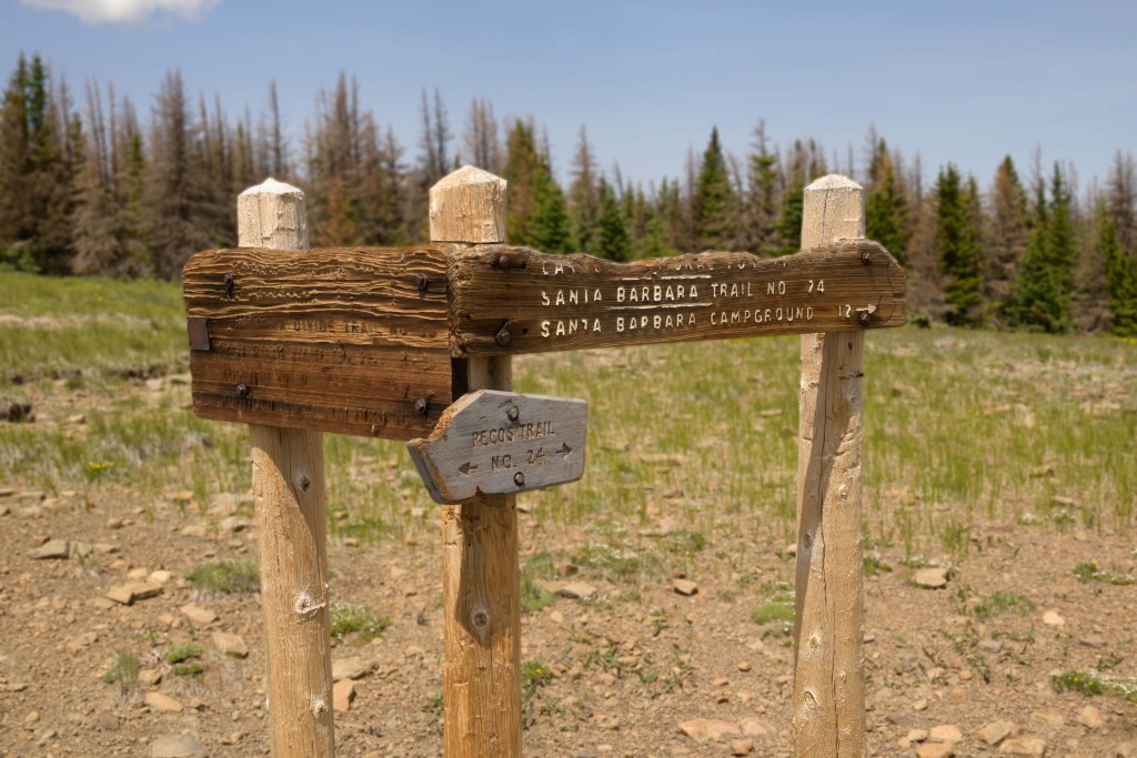
Finally, the East Fork / Divide intersection!
Some views from the East Fork / Divide trail intersection.
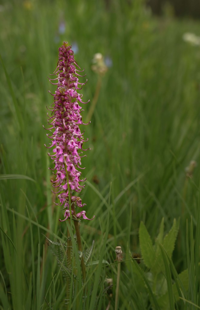
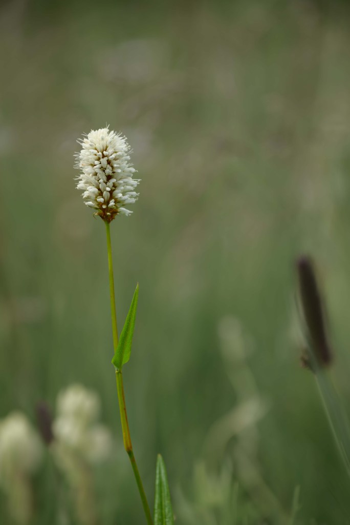
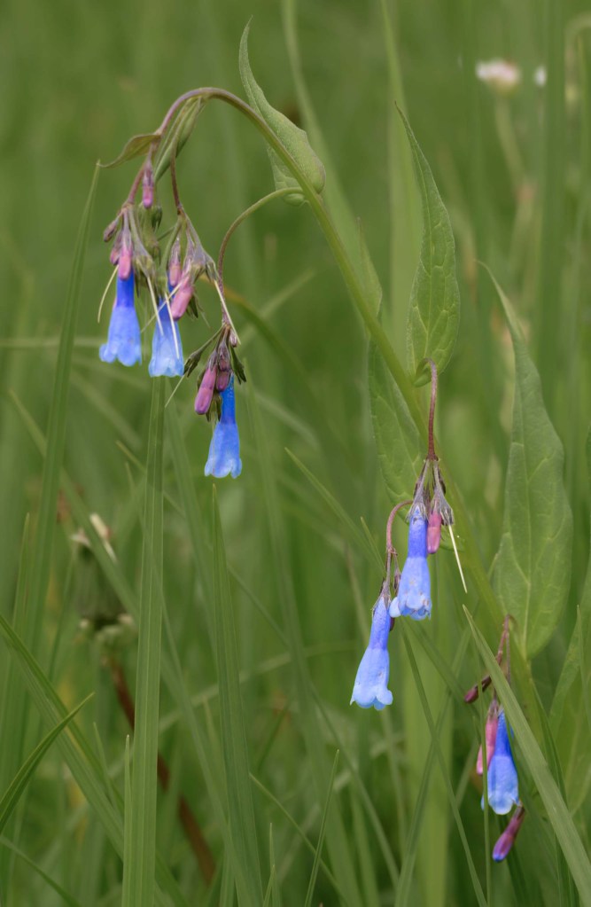
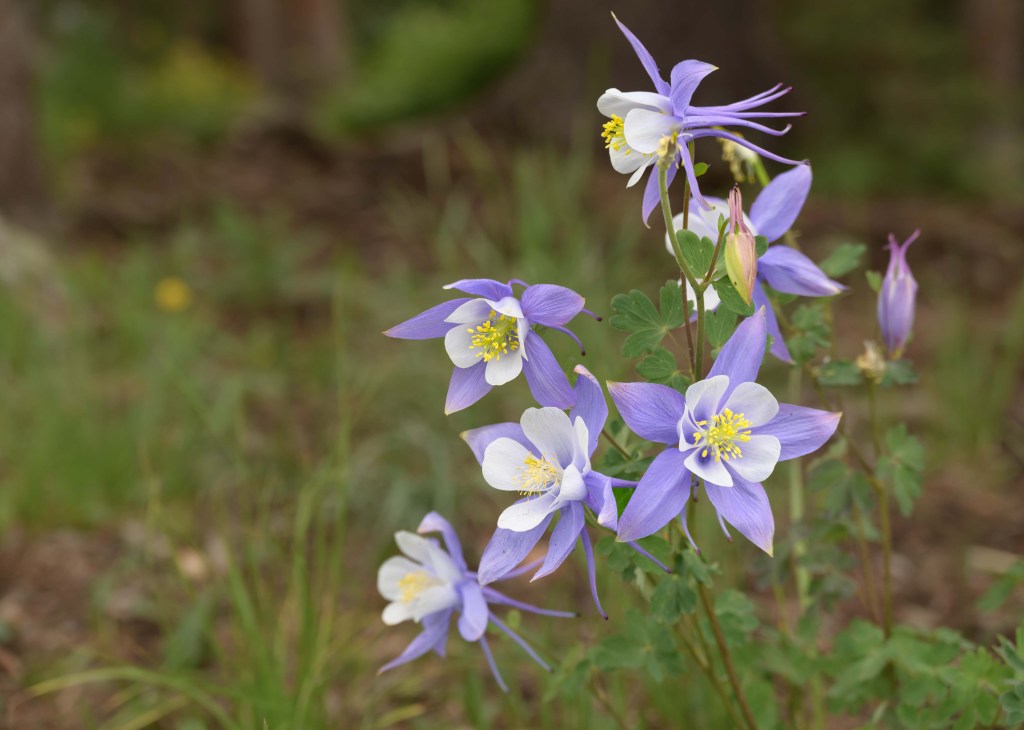
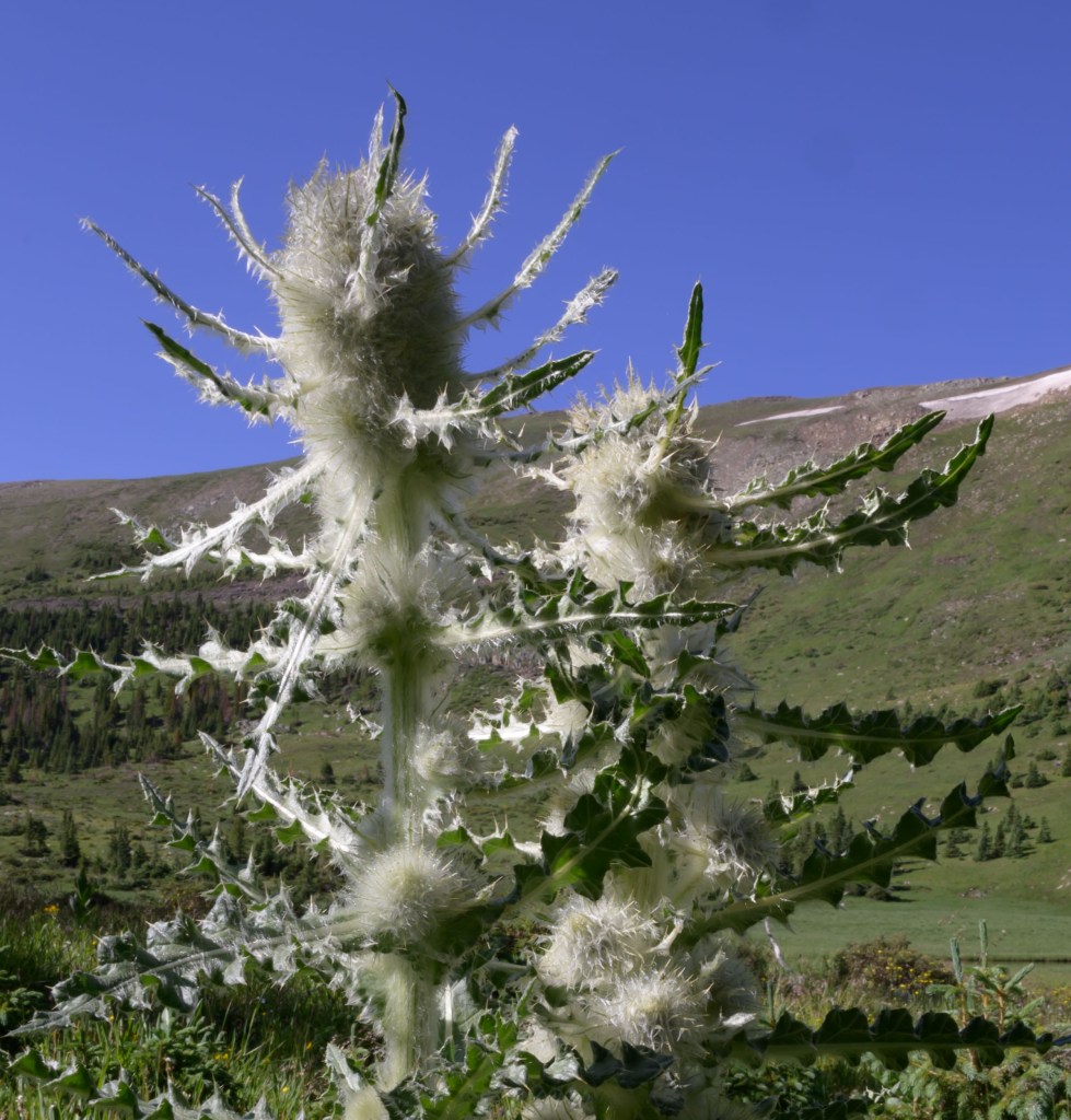
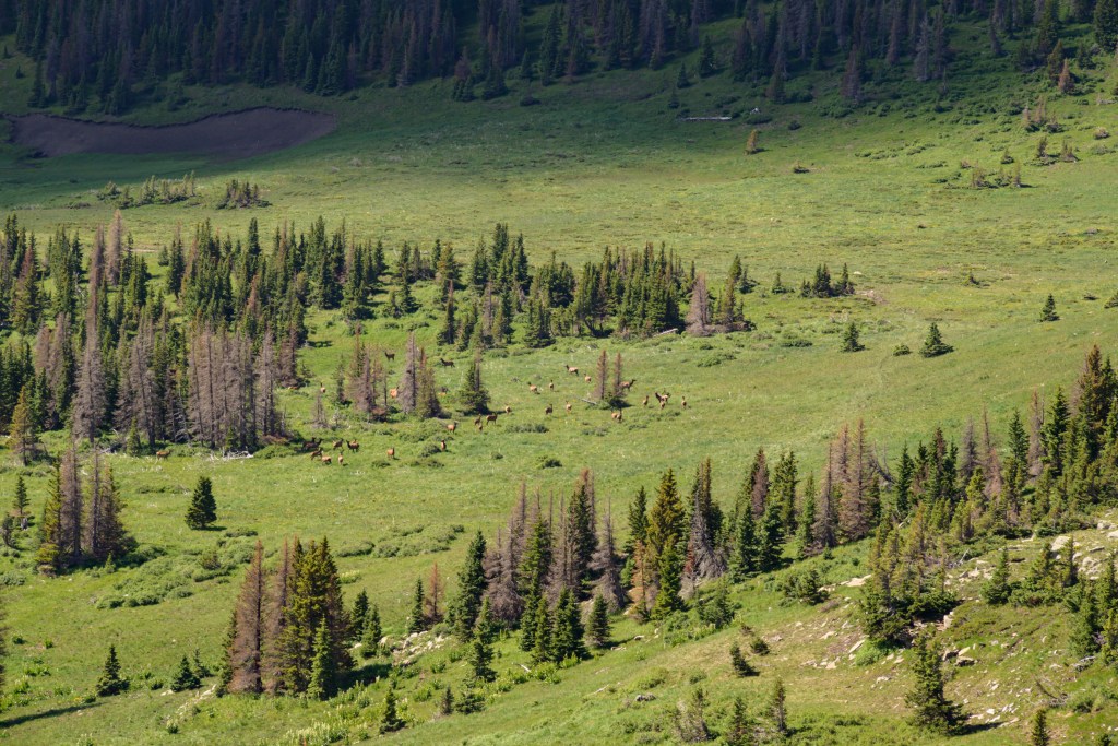
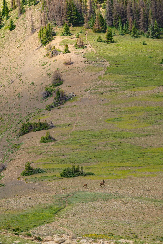
Up along the ridge, on the Divide trail, we saw more wildflowers and (real) wildlife.
Wildflowers and elk along the Divide Trail.
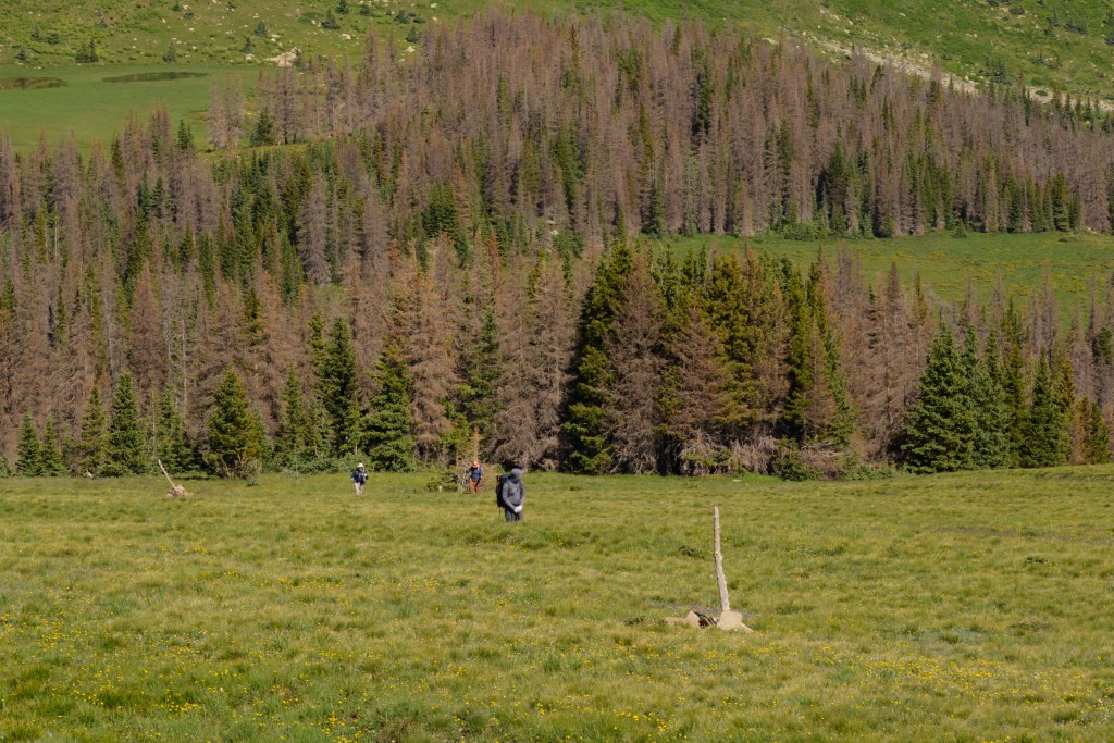
From our previous trip, M- and I were acquainted with the “Hill of Woe” (aka, Santa Barbara peak) that inserted itself rudely on the trail between the East Fork and Middle Fork. It wasn’t as bad this time, since we hit it earlier in the day compared to last time, but we still got beat going up it by fat yet fast marmots.
Coming up the Hill (looking east)
Looking down the Hill to the west
Looking back east at the Hill, after hiking past the Middle Fork
Amazing view from the top of the Hill
Hill of Woe (aka, Santa Barbara peak)
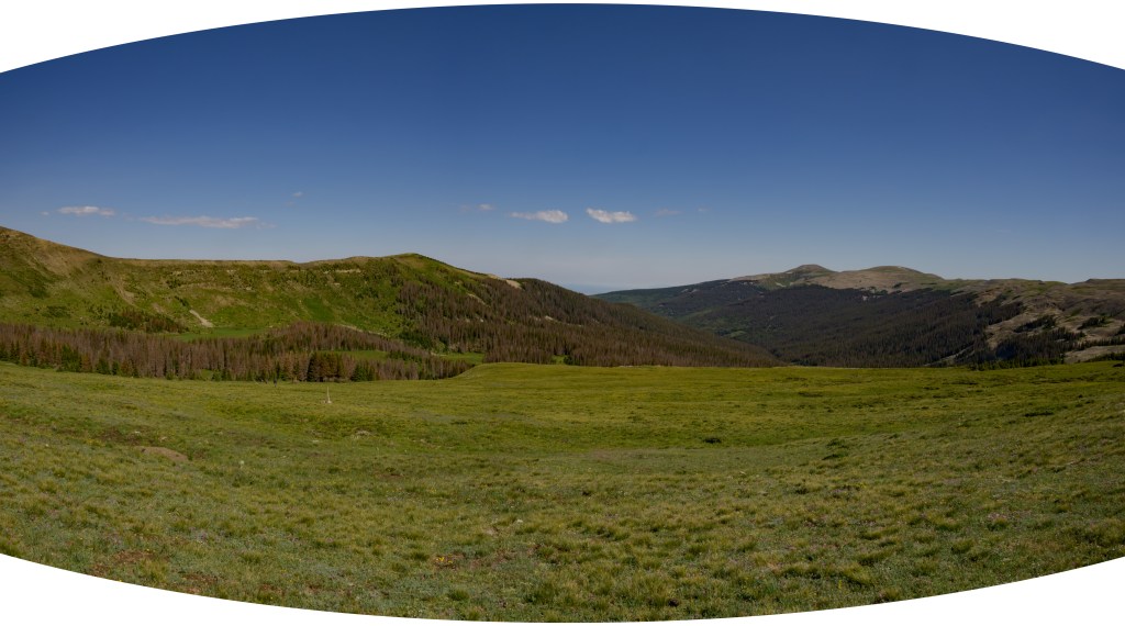
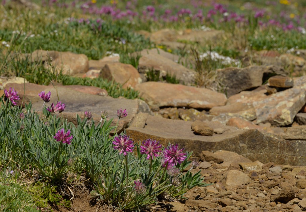
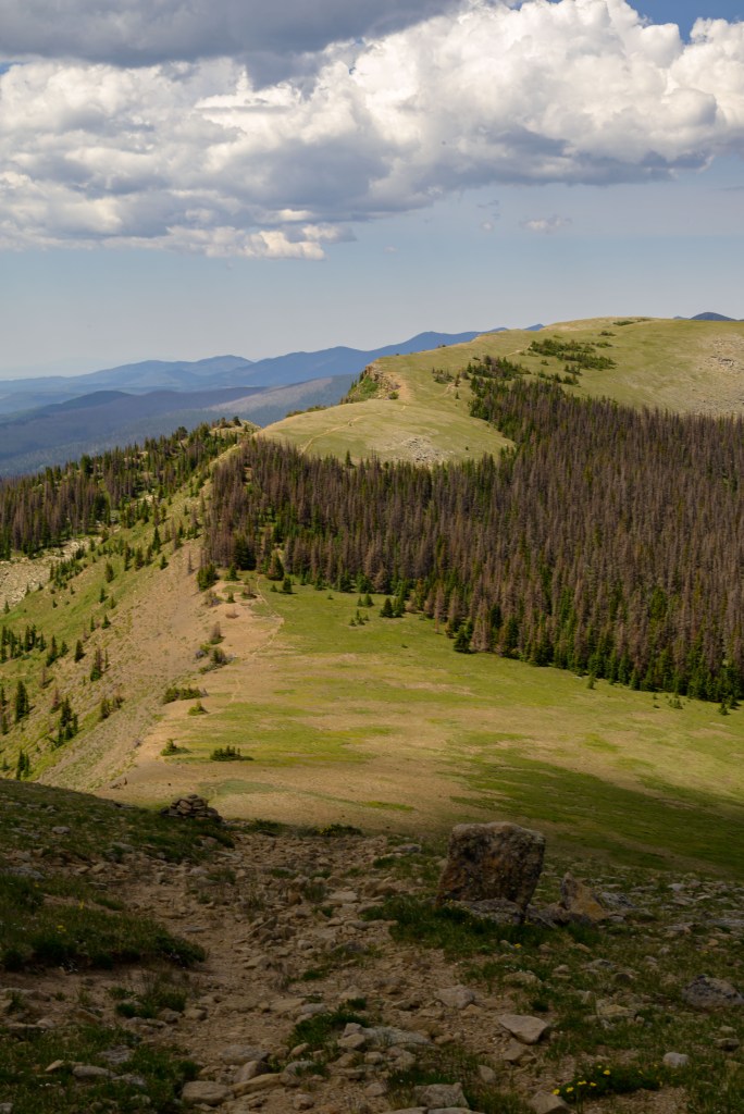
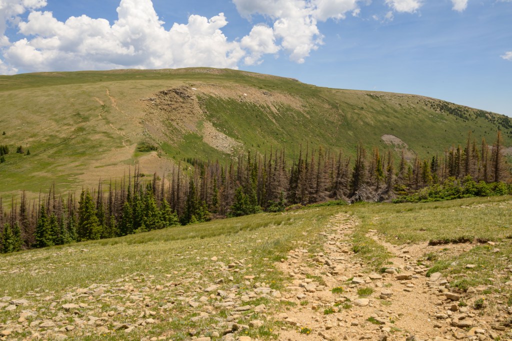
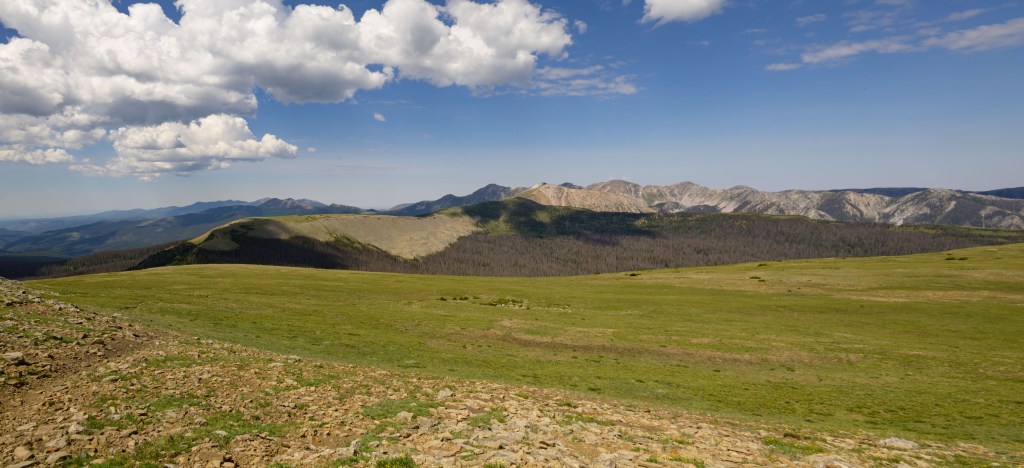
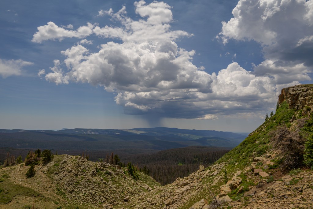
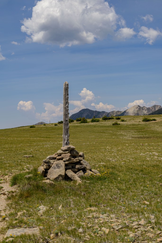
The Big-I of the Pecos Wilderness (Betty’s, Middle Fork, and Skyline trail) marked the start of a relatively easy portion of the hike, where we had a lovely promenade along the Skyline trail. Expansive views surrounded us as we followed either a well-worn trail or the faintest of paths connecting cairns that sprouted at just the right intervals, all the while keeping our eye on the storm developing to the south.
Big-I of the Pecos Wilderness
Storm!
Cairn
Storm!
Strolling along the Skyline trail
Storm!
Well-worn trail on the ridge
Storm!
North Truchas peak
Chimayosos peak
Views along the Skyline trail. (I highly recommend looking through these individually; capturing these images is the entire reason I bought this camera.)
While we enjoyed the stroll along the ridge, we were also trying to keep a good pace, since we needed to get around Chimayosos peak to the south, up and over a saddle between Chimayosos and North Truchas peak, and then down a scree field on the north side to our target campsite just below treeline at the top of the West Fork—all before we got caught out in the open during the afternoon monsoon and lightening storm. Unfortunately, I was the weak link and just after the last photo above, I called a halt for a brief break that turned into me trying not to puke, presumably from a combination of exertion (climbing up to the ridge), sun exposure (being solidly above treeline) and high altitude (above 12,000 ft. all day). A- felt better than me, but was also impacted by the environmental effects; we both dove headlong into a small copse of pine trees and sat in the shade for an hour or so, trying to recuperate enough to continue the journey. At some point in here, I was seriously considering bushwacking straight down to the south and making our way to and then along Betty’s trail, since the only real cure for altitude sickness is to get to lower elevations; I wondered which would be worse, continuing on my own empty energy reserves or calling (and waiting on) mountain rescue (if we even could).
Finally, M- interrupted my reverie and impressed upon me that we really couldn’t stay where we were any longer—while the storm to the south that we’d been watching all day meandered away, a different storm had brewed out-of-sight just over the ridge to the north and was popping up and over immediately onto us. Luckily, enough time had passed that I no longer felt completely inept (though I was by no means fully recovered). M- and Z- graciously offered to shoulder some of my weight, and we all slung on packs and continued along the trail.
As we rounded the south side of Chimayosos peak, we dipped below treeline while the storm to the north evaporated (or in hindsight, more likely just hid behind Chimayosos; but at the time, we thought the monsoon had missed us for the day after all). Bolstered by the trees and the sunshine, we took another break and contemplated setting up camp here. After a couple of hours of napping and rehydrating, though, we all felt much improved and decided that since the storm had disappeared, we could make it over the saddle and to our original target destination after all. Off we went again, along what turned out to be a gentler-than-expected final climb to the saddle, during which, you guessed it, our storm-friend reappeared with gusto. By the time the lightening and hail started, we were simultaneously back above treeline (not good), but also closer to the trees on the north side where we were headed than on the south side from whence we came. Nervously, tensely, and quickly as we could muster, we made the final push over the saddle and down the scree, luckily (and I’m pretty sure it was just luck) without electrocuting ourselves. Naturally, to continue to follow Murphy’s law, as soon as we got to the relative safety of the pines on the north side, the storm went who-the-hell-knows-where, full sunshine shown upon us, and the air turned muggy as the Midwest.
After all that excitement, we had a fairly pleasant walk down the West Fork a mile or so to the campsite M- and I had passed by on our previous trip. It’s an absolutely lovely spot, good flat ground covered in soft pine needles, next to a small stream that’s perfect for refilling water supplies, and also for an invigoratingly ice-cold splash-off “shower”. While we made dinner, a gentle rain began to fall, so we bid each other adieu, crawled into our tents, and slept off the day’s adventures.
The next morning, we were all more-or-less refreshed (as long as no one asked us to turn back uphill). We drank some coffee while watching the sun rise, and then headed down the last stretch of the West Fork to end our loop back at Santa Barbara TH, thus concluding this year’s birthday backpacking adventure.
Sunrise at top of West Fork
Sunrise
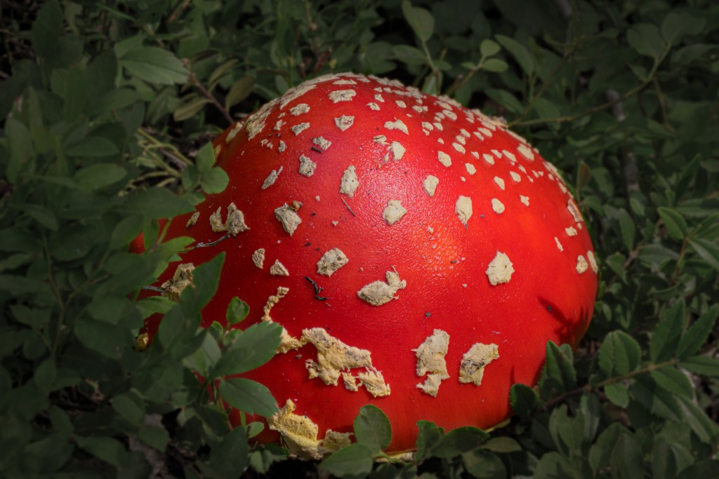
Mushroom from Alice in Wonderland
Looking back uphill towards the ridge we were on the day before
Looking forward downhill towards the end of this year’s journey
Day 3
Bonus content: I snapped some pictures with my cell phone, which maintains a convenience factor over my Nikon. Below are some amusing anecdotes from the trip.
Peaceful as a baby napping under a tree in the rain (Day 1)
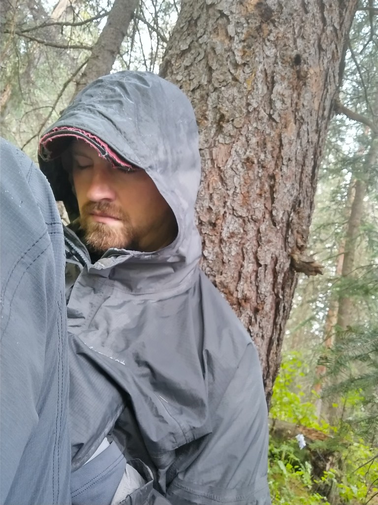
Doing an admirable job looking like I don’t feel like I’m on death’s door on Day 2
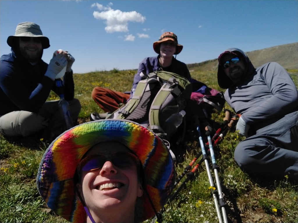
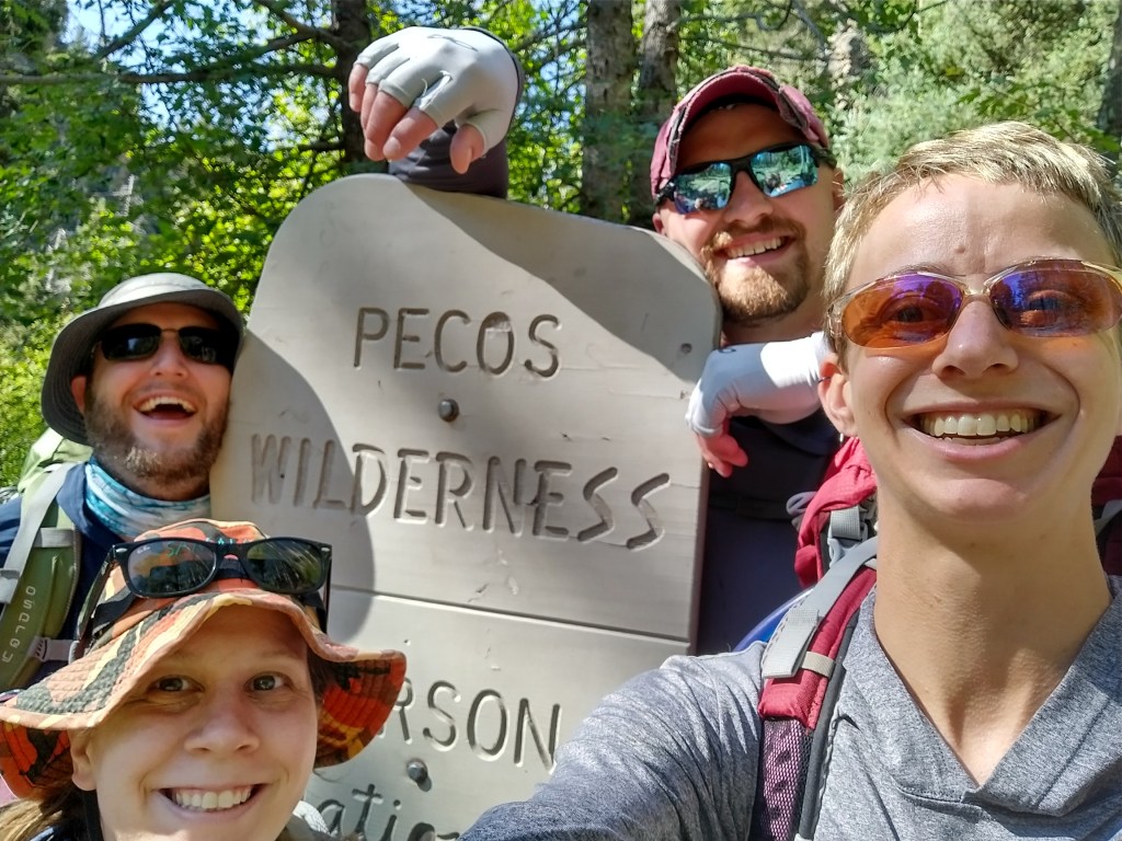
Enthusiastic entrance to the Pecos Wilderness on Day 1
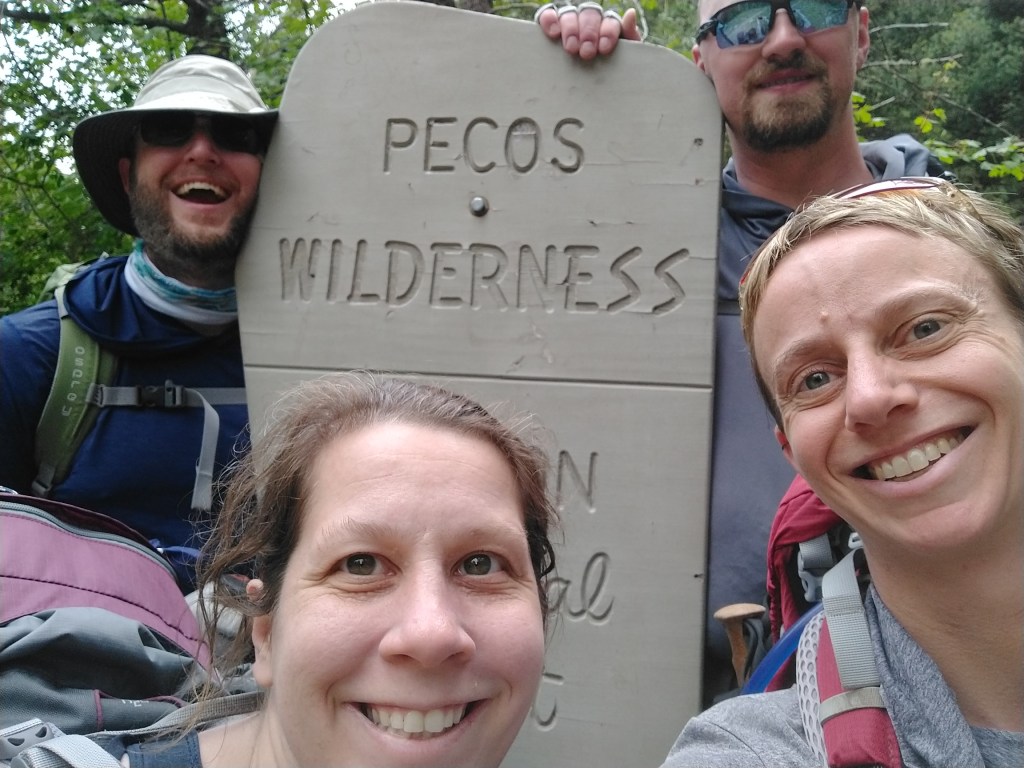
Exiting the Wilderness on Day 3. 1st place goes to Z- for having an identical smile as Day 1.
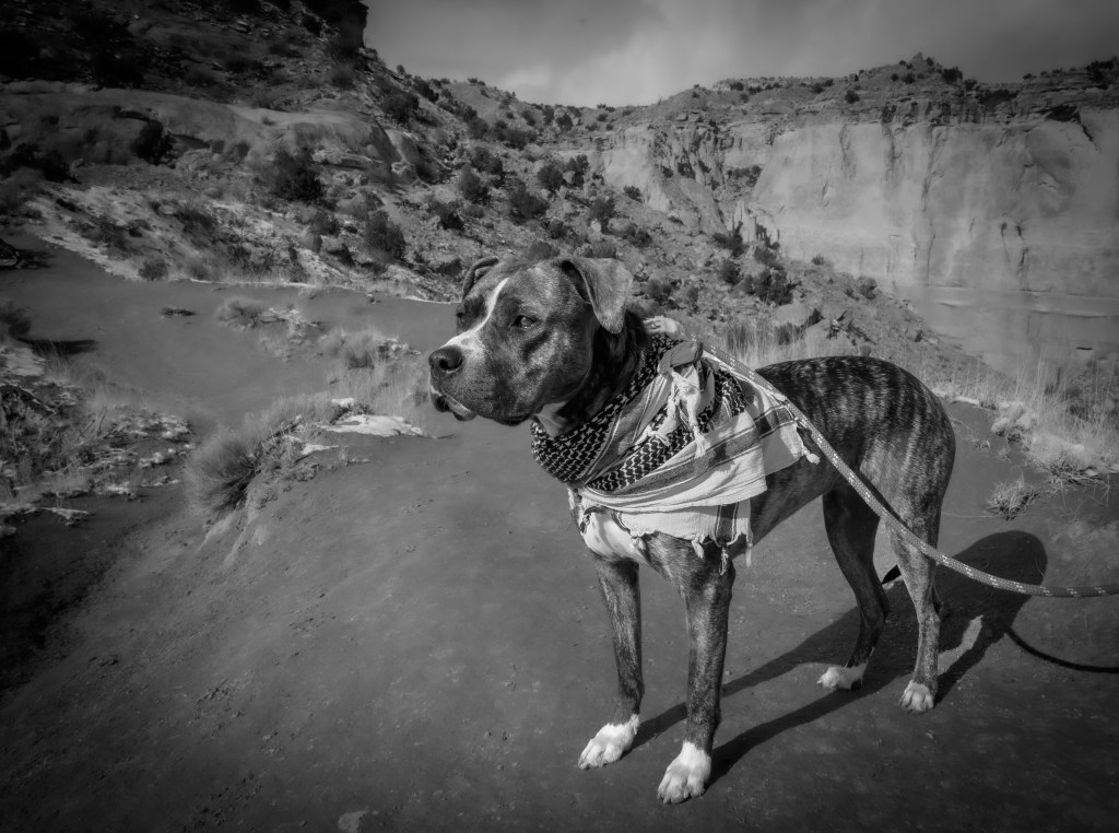
While sister J- came out for three weeks, we had some adventures. Here are just a couple of them.
White Mesa
White Mesa is a really neat area, mostly full of white gypsum, leading to the name. There’s also some springs that form cool mineral deposits in the valley below the mesa. The area is nearly devoid of any vegetation—it’s totally exposed with not a tree in sight. Because the sun can be brutal, we usually reserve hiking there for winter. However, we’ve wanted for years now to try hiking it in the summer by moonlight. No only would it be cool enough at night, but we figured the moon would provide ample illumination after reflecting off the white gypsum. Unfortunately, astronomy is tricky, and we couldn’t quite find a time with favorable moon phase, sunset time and moonrise time. Not to be deterred, we went anyway, hiking the first part of the Dragon’s Spine by sunset, most of the loop by starlight, and catching moonrise as we were finishing up. It was less light and tougher terrain than promised, but what an adventure!
On the camera side, I wanted to try out HDR photography with the sunset pictures, but I completely screwed that up. Pro tip: get to know your camera and her settings better before going out in the wild. I’m going to practice that today, before my next trip. Meanwhile, I was able to salvage some decent sunset pictures here. I’ll just have to go back (maybe when I can actually hike by moonlight) and try again.
Sun set pictures taken at White Mesa. Most feature Cabezon peak in the distance.
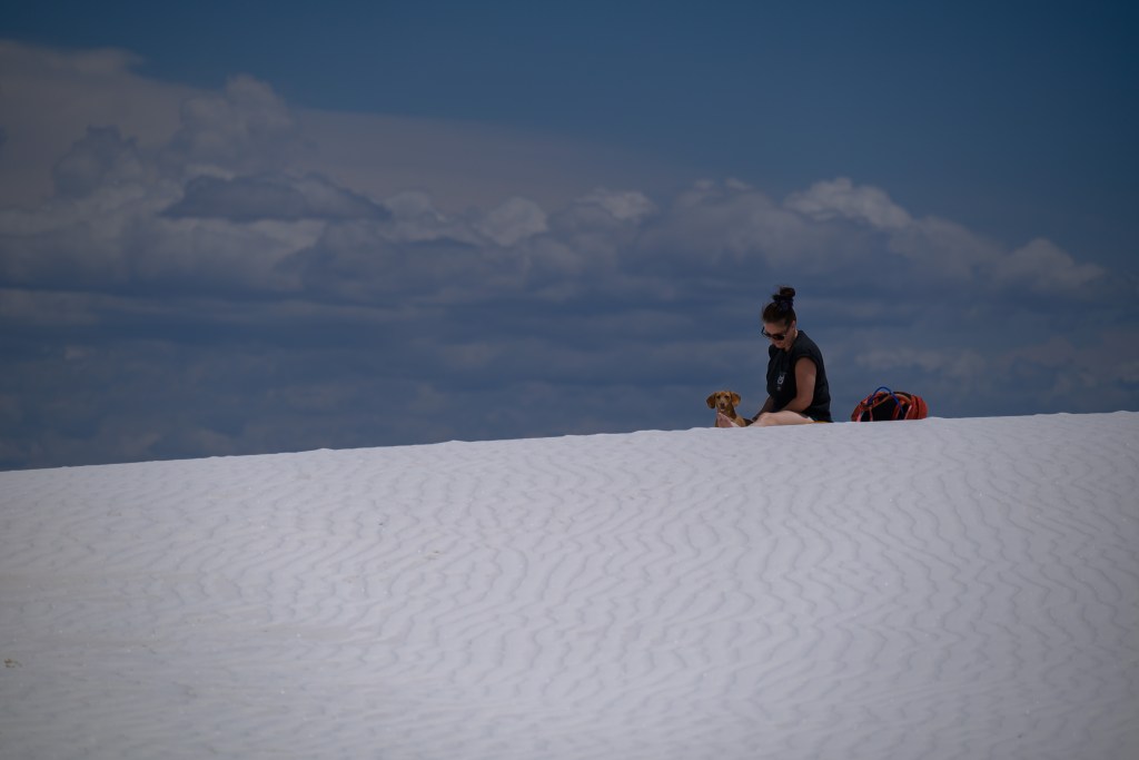
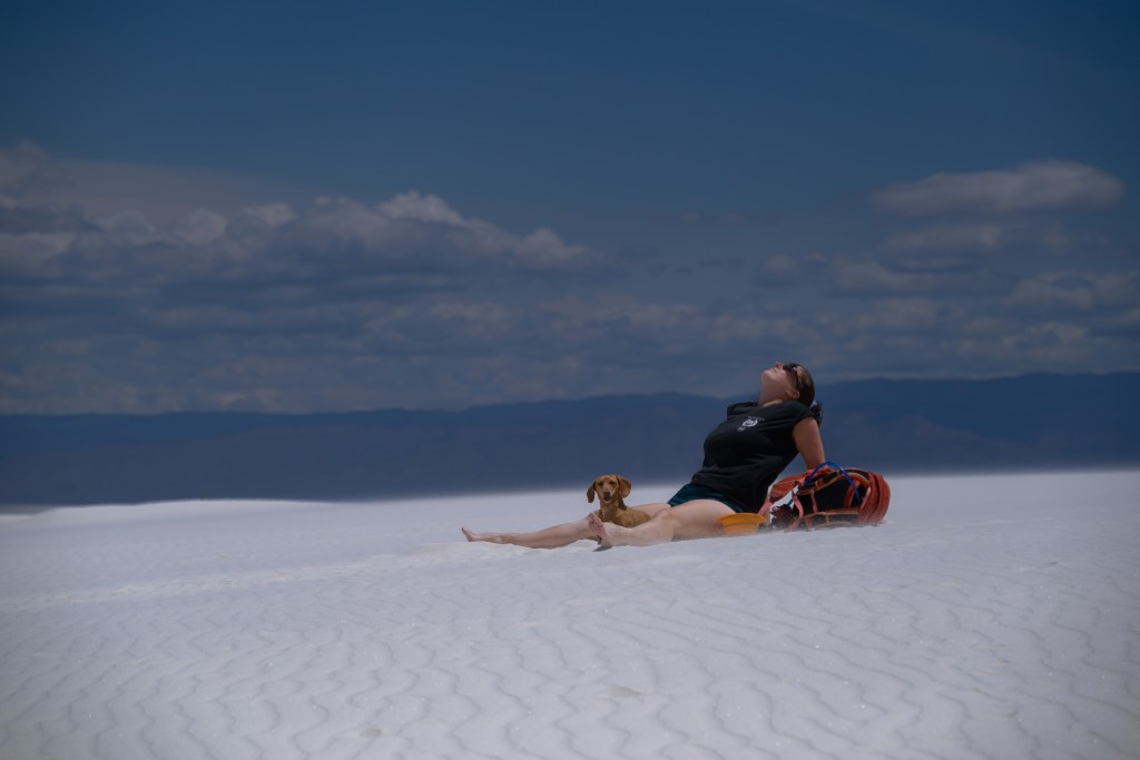
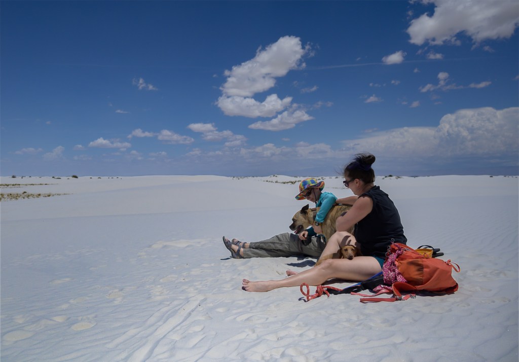
White Sands
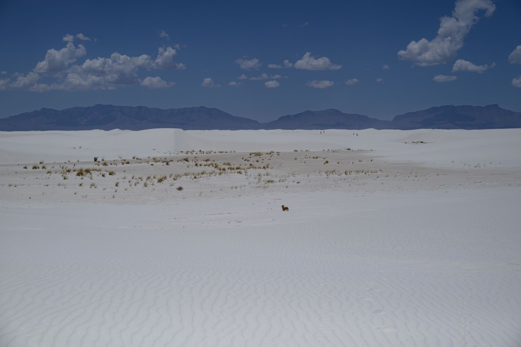
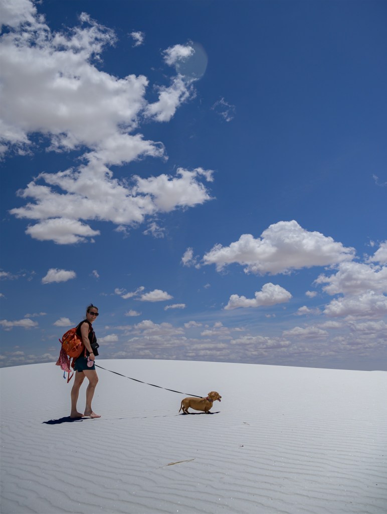
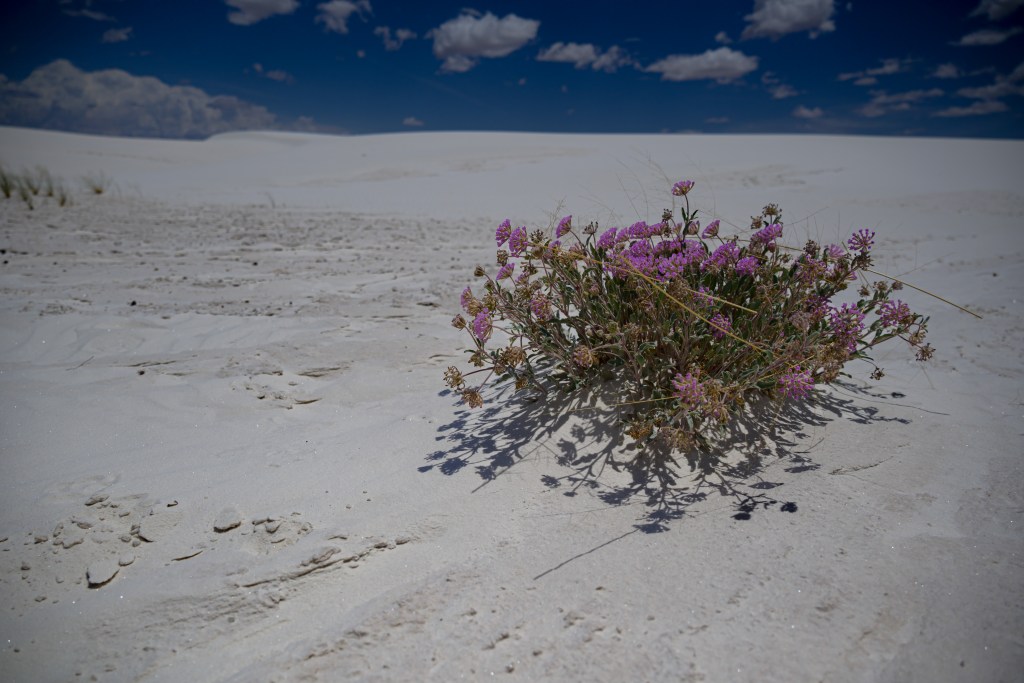
J- and I took Big Blue down to Lincoln National Forest, aiming to scope out White Mountain Wilderness as a possible backpack trip location. We spent a lovely afternoon and evening walking around the dispersed camping area, but unfortunately the Wilderness area itself is currently closed due to risk of landslides from a previous fire. Instead of hiking in the Wilderness, then, we went to White Sands National Park, just an hour further southwest. Good thing I keep the National Park Pass in my wallet at all times! The beach is where J-‘s soul lives, and even if I couldn’t bring her the ocean and humidity in NM, the sand and sun at least partially slaked her thirst.
White Sands National Park
Jemez Mnts: San Antonio Hot Springs
I’ve been to a couple of warm springs in the Jemez and Taos area, but I caught wind of a new one (new to me anyway), so exploring that was on my list. The hike there was 12 miles, though, a little farther than the Illinoisian thought she wanted to go. Instead, we planned the classic Jemez loop, stopping at the Walatowa visitor center, Highway 4 café for a piñon tart, the Soda Dam, and Spence Hot Spring. Next on the loop were Jemez Falls and Valles Caldera, but before we could go there, I requested a tangent to check out a different approach to San Antonio that promised to be only 5 miles instead of 12. I wanted to see if the road I saw on the map was open to the public. It was, and moreover, the forest service folks who were at the TH on their lunch break confirmed the trail I wanted to take. One look between J- and I, no words necessary, and we abandoned the rest of our plans and hit the trail to the hot springs.
It was a lovely path, especially when we got back on it after a little detour bushwacking down a hill. Due to previously-mentioned trail-blazing, though, we were bushed ourselves when we finally made it to bottom of the hill below the springs. Moreover, we were mentally psyched out thinking about having to get back up said trailless hill. After some rest in the shade, a salt tablet and old, stale, tough goo chew each, we felt better, but weren’t prepared to climb up to the spring, only to go back down and then climb up the hill-of-woe again. So after getting within earshot (literally) of the springs, we turned around and headed back without actually laying eyes on them or getting in. Still, it was a memorable experience with some beautiful views along the way, and it was entirely successful as a reconnaissance mission, setting us up for success next time we go up that way.
Off trail adventure near the Thompson Ridge route to San Antonio Hot Springs
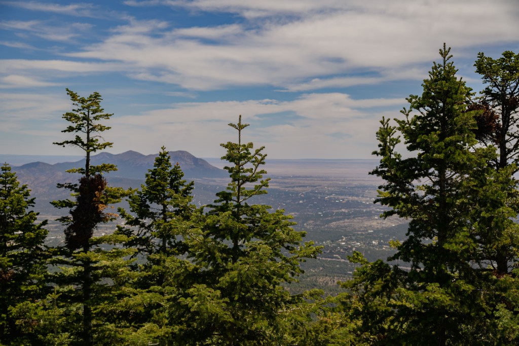
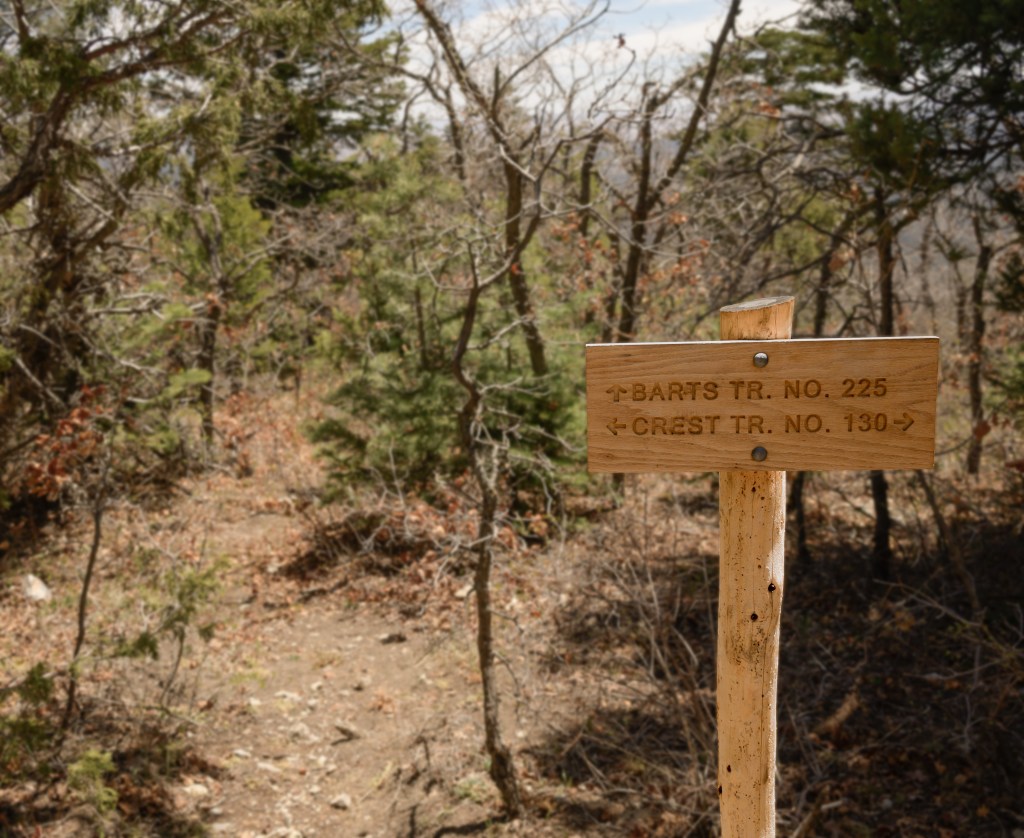
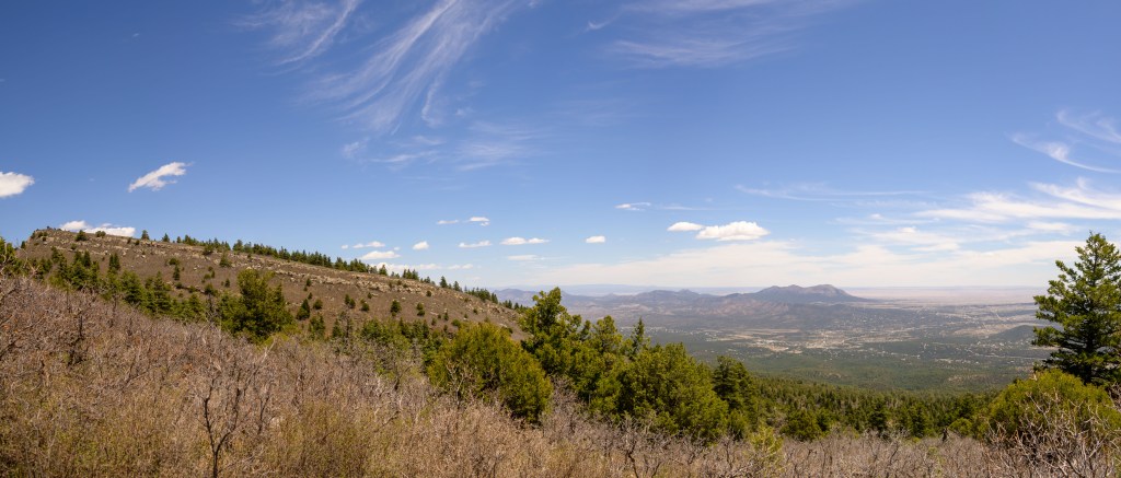
After work one day a couple of weeks ago, Hercules and I went for what started as a normal walk in the Sandias behind our house. I guess he had extra energy from laying around all day, though, because he turned and led me up Bart’s, a little-used trail that heads straight up the mountain. I was digging it for awhile (because I had also spent the whole day sitting at my computer), but for better or worse, we had to do an abrupt U-turn about half way up, since we were not prepared for an after-work walk to turn into such a long and arduous hike before sunset. That dally onto Bart’s was just enough, though, to get me fixated on finishing it another time, especially since I had tried and given up on it once before a couple of years ago. The next weekend, I packed water and snacks and set out again. It’s about 3 miles from my house to the start of Bart’s proper, and by the time we got there, Hercules clearly and purposefully turned on Faulty, which runs parallel to the contour lines, and not up Bart’s. Apparently, he wasn’t feeling it that day, and I’ll be honest, I wasn’t either. While we had an enjoyable walk that day, I became even more infatuated with finishing Bart’s. This weekend, along with Hercules, Fitz, and M-, I finally conquered it—10.5 miles with 2500 ft gain; certainly not the hardest hike we’ve done, but definitely more than the walks we’ve been doing lately. The sweat and oxygen deficiency was worth it, though, and made the views at the top all that sweeter.
Views to the east, just below the intersection of Bart’s and the Crest trail, and along the Crest trail between Bart’s and Cañoncito.
M- and the pups scoping out vantage points for me.
Amazing view to the west, right at the intersection of Bart’s and the Crest trail.
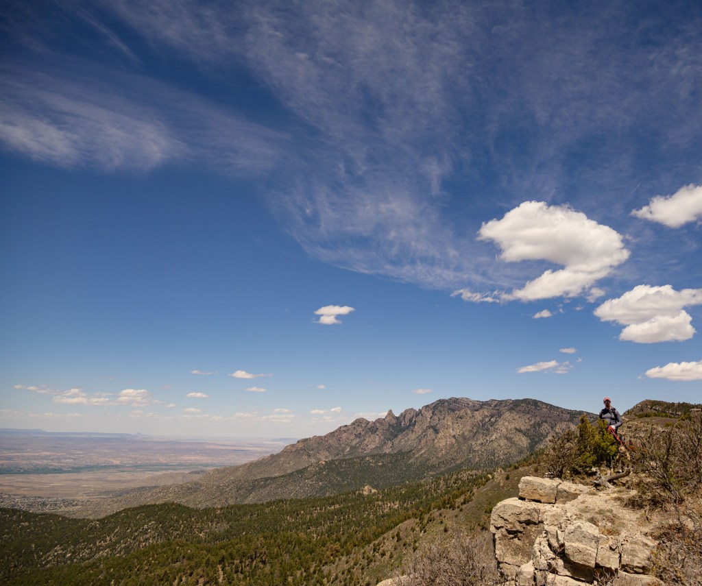
M- and the pups waiting under a shade tree while I take some pictures along the Crest trail.
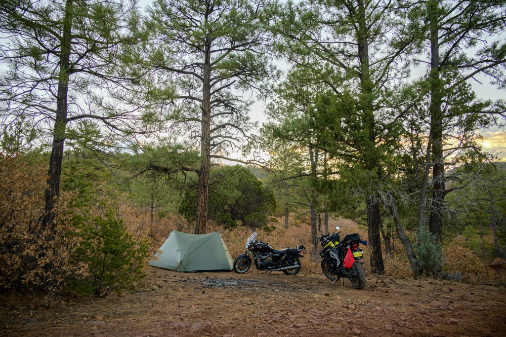
We were going to head to Aguirre Springs campground and hike Baylor Pass for a short weekend get-away with the other J-s. Unfortunately, it’s a first-come-first-serve campground, and even though A- called ahead of time and the ranger said there should be room, the campground was full when we arrived, and there isn’t any dispersed camping in the area. After considering and dismissing some close KOA’s and even motels in Las Cruses or Alamagordo as not conducive to our chi, we instead headed back to Lincoln National Forest east of (and critically, as you’ll see later, above) Alamagordo. M- and I had an initial foray into the area over Thanksgiving and knew there were lots of good spots just off FR 90. Importantly, we also knew FR 90 was a decent gravel road that the other J-‘s motorcycles could get down.
Indeed, we found a good spot. Waking up in the woods really does center my chi. Below are a few photos I snapped while everyone greeted the morning. I got a little obsessed with the alligator cedar for awhile. Usually, most of them I see look a little worse for the wear, a bit lopsided and mangled, but this beauty was pristine and uniformly spherical. M- made fun of me for my enthusiasm and the action poses (not shown) required to get the angles I wanted.
Campsite
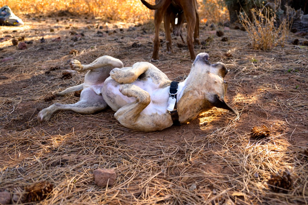
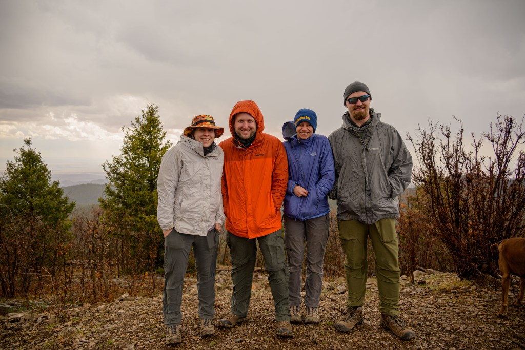
The pups enjoyed the campsite, too. While everyone was drinking coffee, they were exploring nearby and chasing sticks and frisbees. After a bit of a rough start, Type 2 fun from Friday started to soften some into at least Type 1.5 with the idyllic Saturday morning. With no real agenda, we enjoyed the morning and then started to plan the next move. FR 90 roughly follows a contour, with the ridge a couple thousand feet up and to the east, and Alamagordo a couple thousand feet down and to the west. All trails lead either straight up or straight down, pretty much perpendicular to the contours. There was unanimous disinterest in putting that kind of effort into our day, so we decided to drive back out of the forest, up from High Rolls to Cloudcroft, and then dive back in on the ridge road, from whence trails would be flatter.
Doggos
It was a good plan, but none of us really considered the ramifications of being 75 miles east and 4000 ft higher than we originally planned. We had checked the weather for Aguirre Springs—high of 83 F, low of 50 F, full sun. We had not checked the weather for the top of the Sacramento Mnts. It was noticeably cooler up above 9000 ft, but that’s expected and we were still cheery, so undaunted we set up camp a little ways down FR 64 in front of a beautiful valley. Then we headed off to find a trail.
Sunrise Sunday morning across the valley we camped at on top of the ridge.
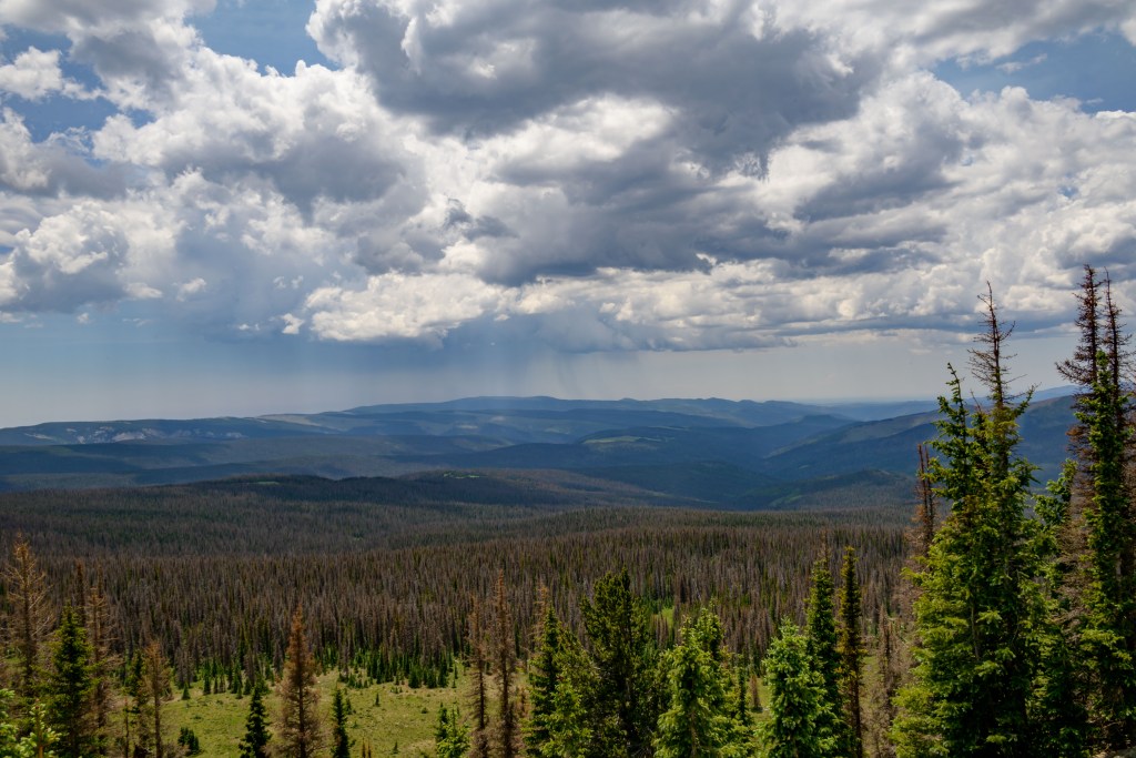
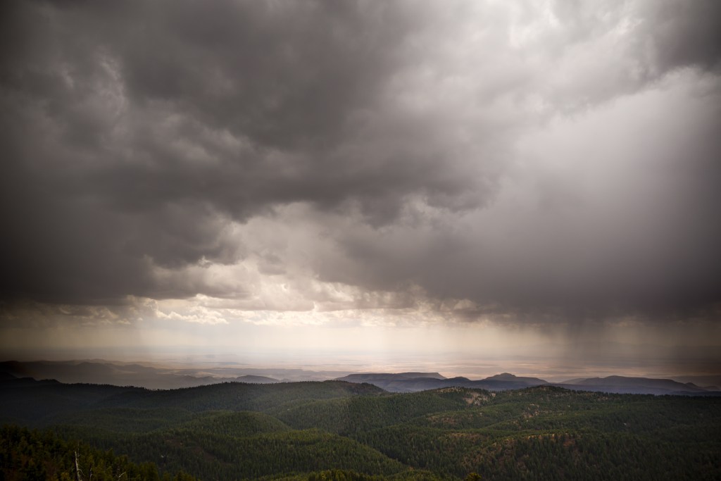
After maybe a mile, we felt the first rain drop and laughed about it. Then we saw our first hailstone and started considering the situation. We all had raincoats, true, but it’s impossible to tell if the storm will just blow over after a few drops or if it’ll let loose. On the one hand, we didn’t want to be weather pansies; on the other hand, we didn’t want to get drenched. Finally, we made the decision to turn around and head back to camp. The hail picked up—enough that the dogs hid under a pine tree for the worst of it—but in the end, it wasn’t terrible. Three cheers for having the camper van, though. We all huddled in there for a bit, warmed up, ate some lunch, and then drove up to the Sacramento Lookout tower. The views from that vantage were breathtaking, though the wind on the unprotected height was fierce. There was a lull in the storm in our immediate vicinity, which allowed me to capture some photos of the surrounding storm.
Quick detour now from the camping story to the photography commentary. The two photos below of the storm took me basically all day to process. There was not a single set of parameters (exposure, blacks, whites, shadows, highlights) that captured both the majesty of the clouds, sun, and rain in the sky, simultaneously with the expansive landscape below. I had to figure out how to divide the sky from the ground and apply different settings to each, while blending the line between them. In hindsight, I suppose this scene is a poster child for HDR photography (capturing an identical scene with several exposure times and merging them all together later), but that hadn’t occurred to me at the time. Anyway, trying to eek out a good final photo from the RAW files I had forced me to learn a little more about working in Photoshop. I probably didn’t do things as elegantly as a skilled graphic designer, but I got something decent in the end. And after spending hours and hours struggling with the first one, I got the second done in what felt like 5 minutes, so I suppose it was a worthwhile investment of a Saturday’s worth of time.
Storm as seen from Sacramento Lookout Tower.
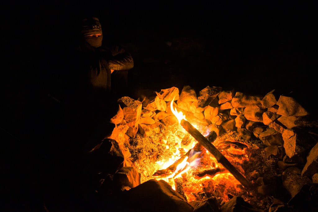
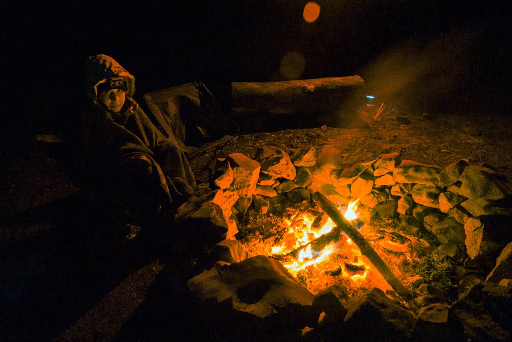
After the lookout point, we napped the rest of the storm away. When I woke up a couple of hours later, the skies were clear and it was decently warm in the sunshine, so we took the pups down the valley from the campsite for a little walk. Seeing what’s around the next turn is irresistible for me, but eventually, I had to admit that it would be more “down”. Hoofing it back up put the final touches on warming me back up. After that, we had a beverage in the last of the sunshine and then enjoyed a campfire for the evening.
Campfire
Sunday morning, we packed up and headed out, stopping at a scenic overlook off Sunspot highway. After a solid brunch at a gem of a local place in Cloudcroft, it was a pretty drive home followed by some personal hygiene and laying around. Overall, about 50/50 for win/bust on this little weekend trip.
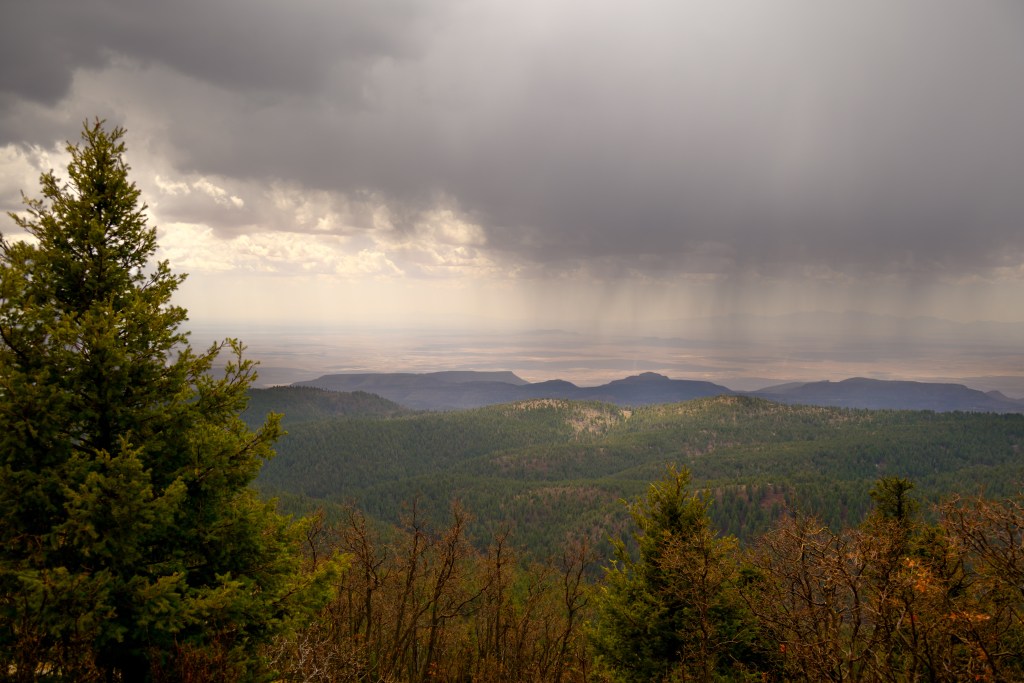
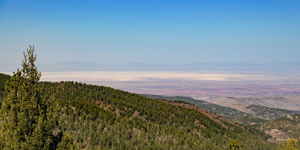
View from Sacramento Mnts, overlooking White Sands with the San Augustin Mnts in the background.